
In October 2018, I travelled to Nepal with Rob Baker and Ryan Castel for a three-week adventure in Langtang National Park. This was my first time in Nepal and the Himalaya. Rob and Ryan both had six previous Nepal trips under their belts, and so brought with them extensive high-altitude alpine experience. Despite this, none of our party had ever visited the Langtang valley, and for all of us this was the first time we had visited the country since the devastating 2015 earthquake.
We planned to climb Naya Kanga (5846m) which we had obtained an official permit for, however we were also interested in exploring the Langtang valley and seeing whether other harder options such as Gangchengpo (6387m) or Dorje Lhakpa (6966m) might be attractive goals for future visits.
For me personally, I was incredibly excited just to visit Nepal for the first time. The mere existence of Nepal and the Himalaya, the photos and stories I’ve read about adventures on the roof of the world, have definitely been the primary inspiration for me to pursue mountaineering as a life path. Having some low-altitude mountaineering trips in New Zealand under my belt, as well as some technical ice climbing experience from visits to Japan and Canada, the natural next step for me was to see how my skills fared under the added difficulties of high-altitude in a developing country that lacks many of the comforts and safety nets of home. I was privileged to have the opportunity to do this with two awesome people, in an authentic self-sufficient style that allowed me to bypass the manufactured off-the-shelf adventures offered by western guiding companies.
1 – The Approach
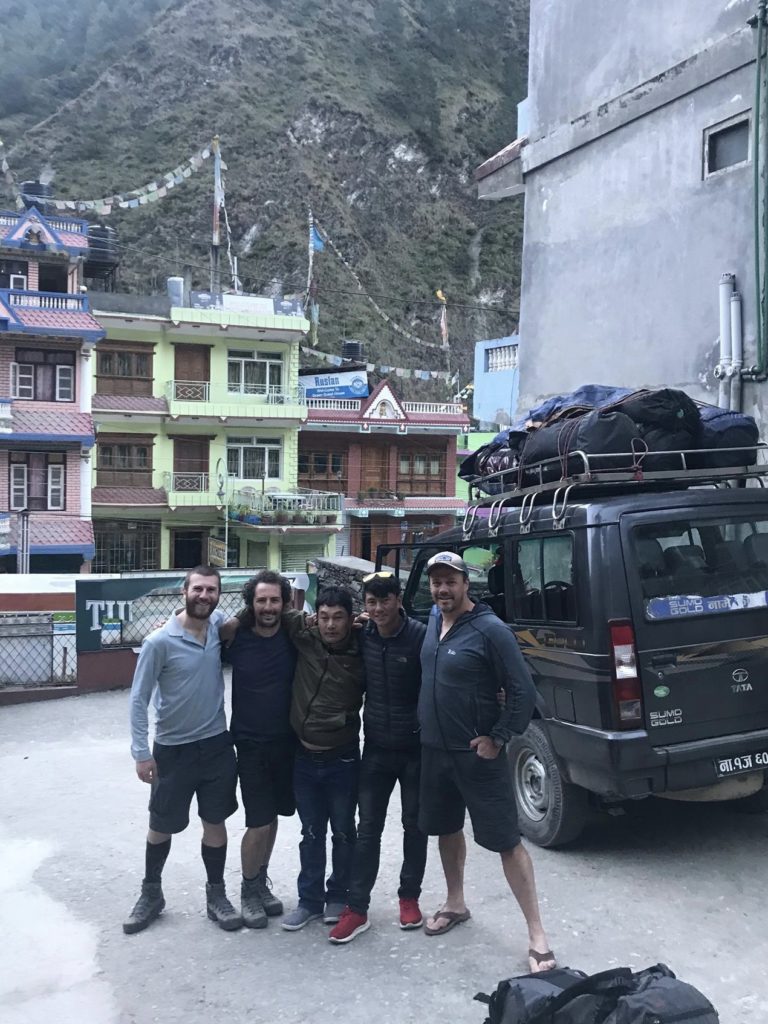
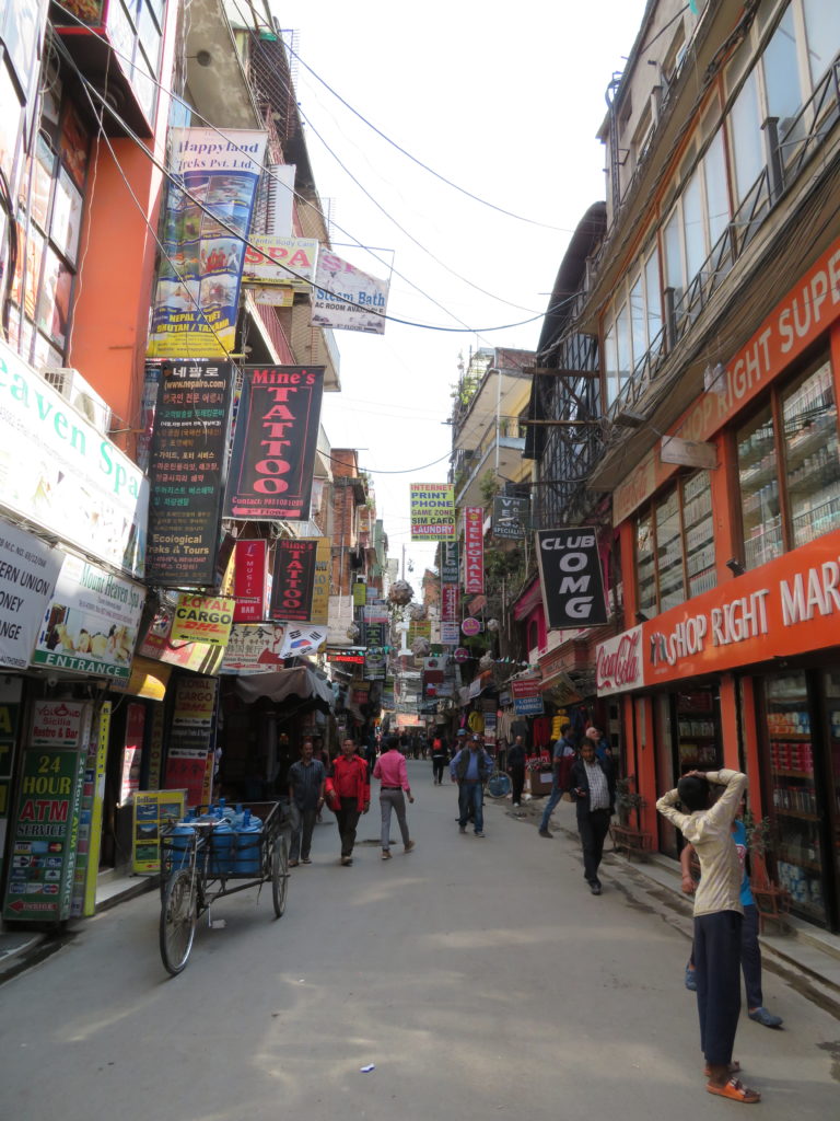
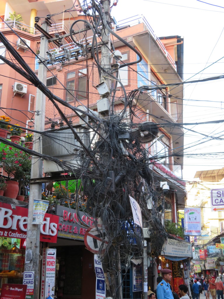
Arriving in Kathmandu for the first time is like landing on a different planet. Different rules seem to apply to everything (assuming there are rules that anyone actually pays attention to). The city has an ordered-chaos which gives it a certain intensity. Its rich history and cultural complexity I can’t claim to understand after only one visit. We spent 2 nights in Thamel tourist district, buying food for the climb and getting prepared through our local agent Nima.
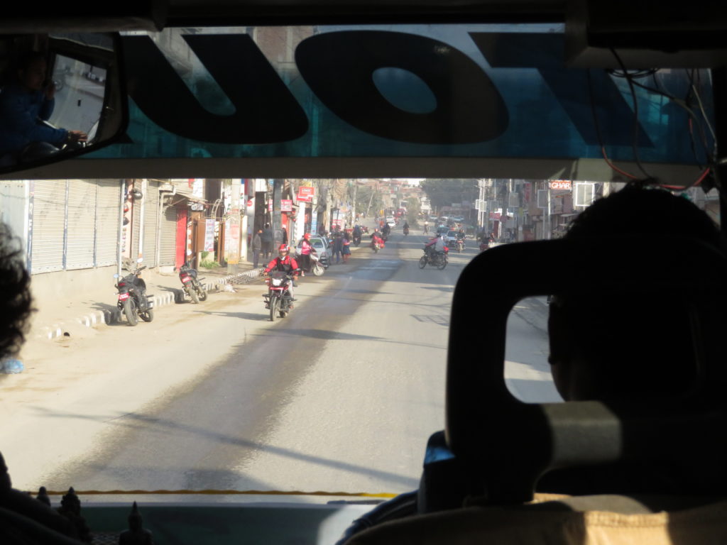
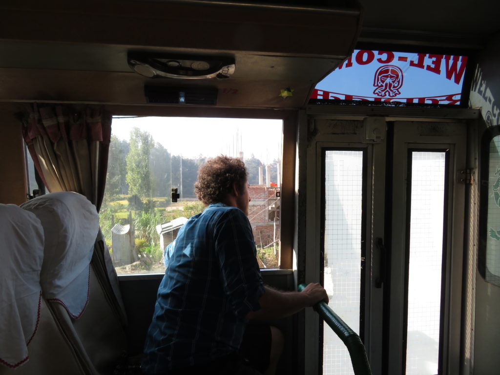
A bus arrived to take us to Syabrubesi where we would begin our trek. Accompanying us were 2 Nepalese climbing staff, Sonam and Nurbu, who would help us with ferrying gear to our high camp on Naya Kanga. They were a welcome addition to the party: well organised and extremely helpful as translators, and much more acclimatised to altitude than us. The seven-hour drive along the ‘highway’ (i.e. worst road I’ve ever experienced) was rough and exhausting, but views of immense valleys and glimpses of distant peaks kept our excitement alive. There was so much to look at and take in driving through the Nepalese countryside. This is a developing country in a curious state of transition: many people are living in conditions most westerners would describe as poverty, yet somehow there seems to be almost universal access to modern smart phones and wifi.


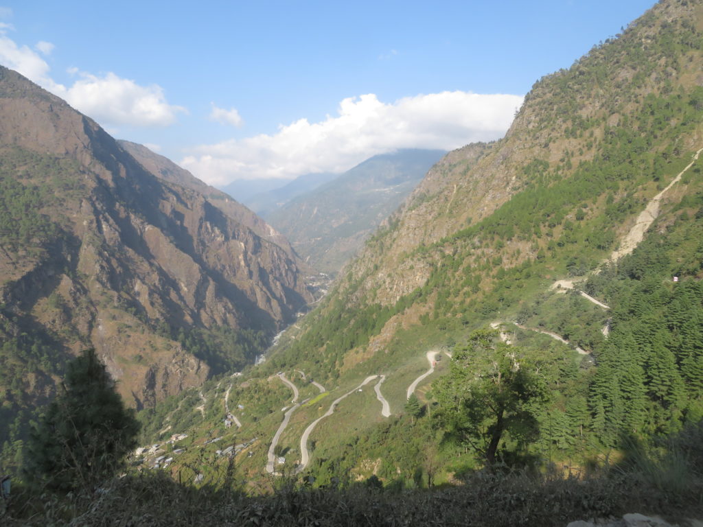
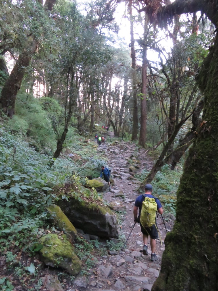
Day one of our trek from Syabrubesi (1460m) to Rimche (2455m) saw us gain roughly 1000m in elevation. Donkeys accompanied us on our trek, helping to ferry our bags of climbing and camping gear up the steep track. We rested after 7 hours of walking in the local accommodation, where we were introduced to the typical food that would become standard during our time in the valley.
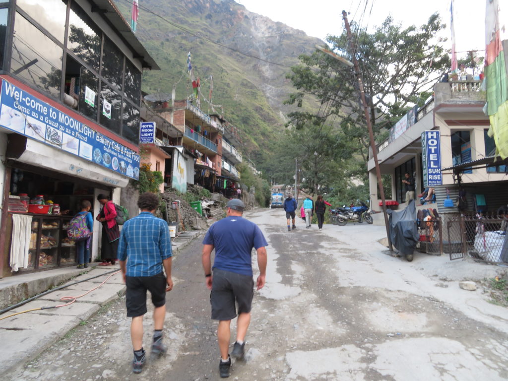


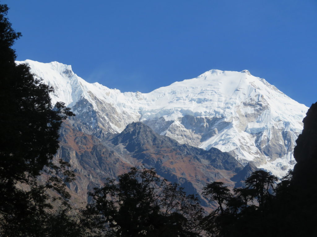
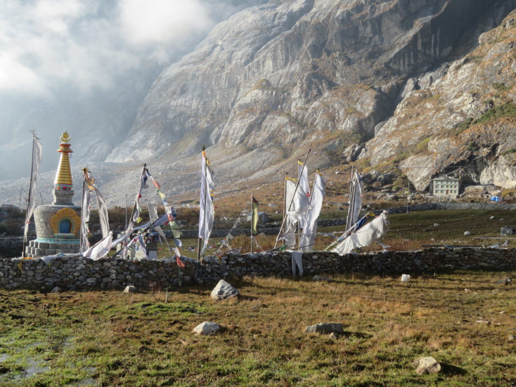
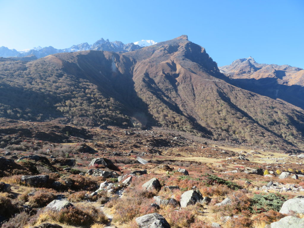
Day two saw us gain another ~1000m, walking through incredibly beautiful rhododendron forest next to gushing rivers, and we had our first close up glimpses of the massive Langtang Lirung peak (7227m). We rested in Langtang Village, which had been reconstructed since the 2015 earthquake. The destruction of that event was obvious, with debris from a huge landslide completely burying parts of the old village. Memorials stood in honour of those who perished, with over 200 being an alarming number given the small size of the community.


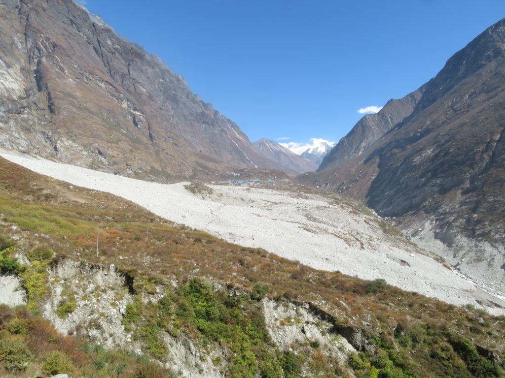


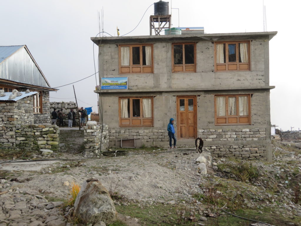
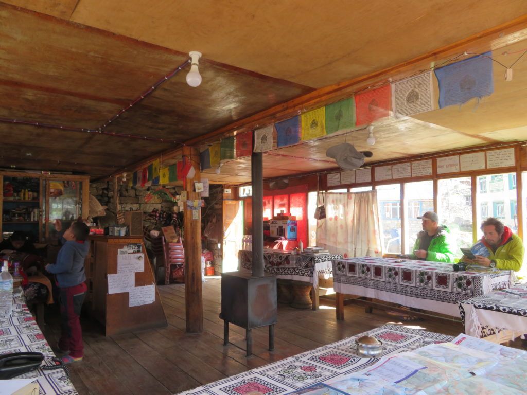
Day three was a relatively short day gaining only ~300m. However, the altitude, as well as head cold that Ryan and I had caught, made the walking start to get more difficult. We arrived in Kyanjin Gompa (3800m) after only 2 hours and collapsed. We had a much-needed rest day the following day which allowed Ryan and I to start recovering from our colds. Despite most buildings having electricity and solar hot water, the village had a medieval feel to it, with the farm animals everywhere and the lack of roads giving the impression we had stepped back in time to a simpler part of human history.


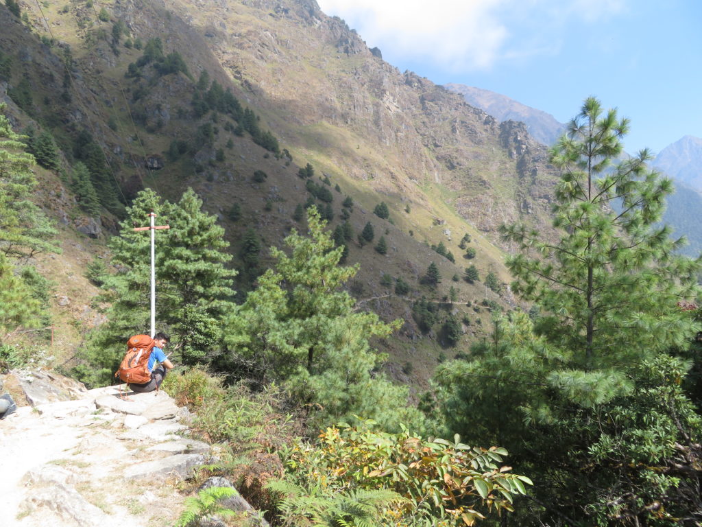
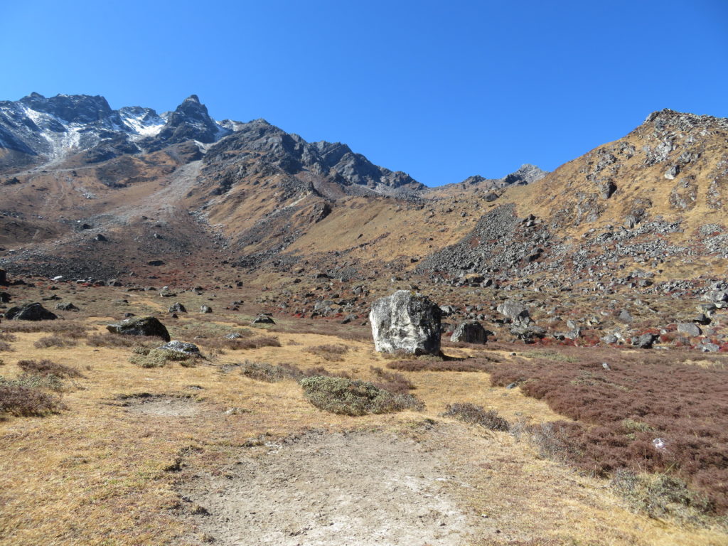
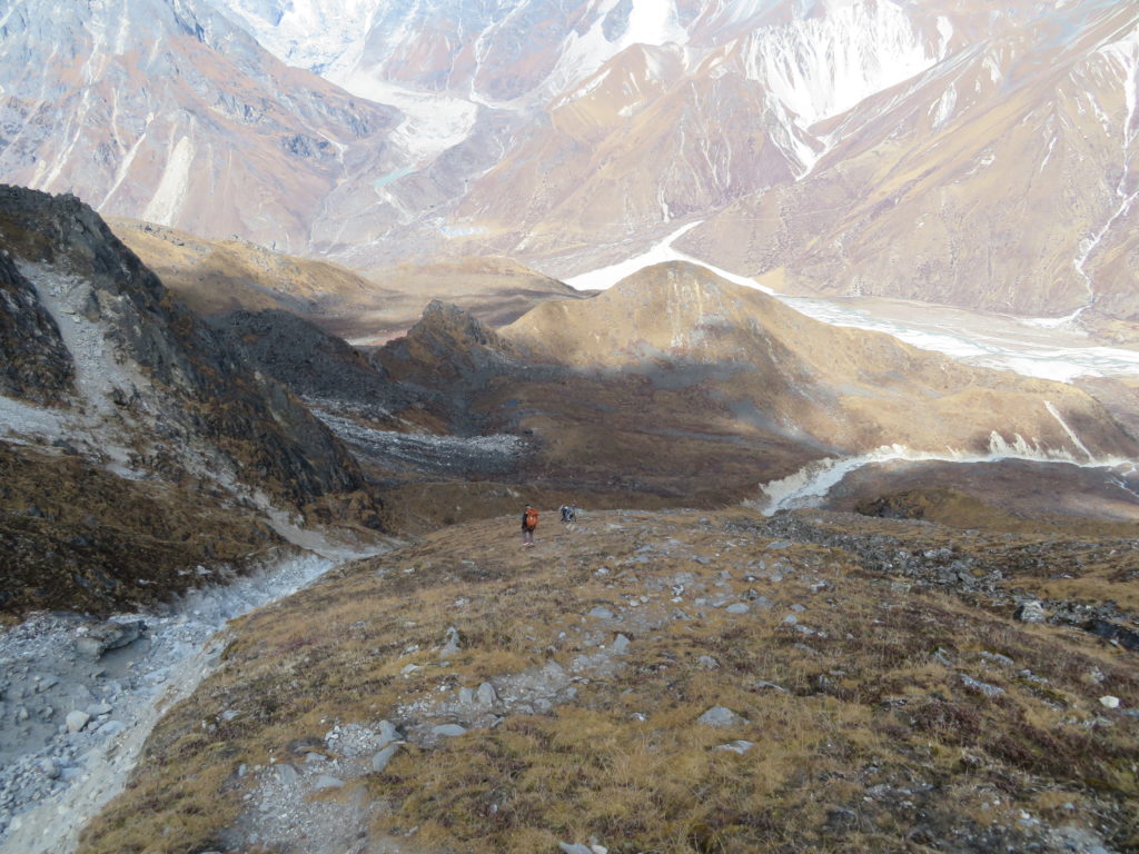
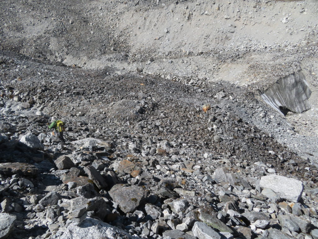
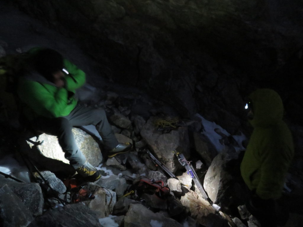
After our rest day we got to work ferrying as much gear as possible to the high camp of Naya Kanga, at approximately 4900m on the glacial moraine. We carried gear up with the help of Sonam and Nurbu, where we stashed it before returning to Kyanjin Gompa to rest. We noted at high camp that there were no fresh water sources, meaning we would need to go up again with sufficient water for 3 days. For me this acclimatisation carry-day lasted 10 hours, and for the first time I was strongly affected by the altitude. Every step forced me to suck in big gasps of air, and I moved incredibly slowly. When the face of Naya Kanga came into view, it looked impossibly steep and unclimbable to me in that unacclimatised state. I got a headache which didn’t disappear after drinking more water and taking ibuprofen, so I begrudgingly took a Diamox to try and prevent it getting worse.


2 – The Unexpected Emergency
On sitting down for dinner in Kyanjin Gompa after our long carry day, we were more than ready to have an early night and a rest day. However, before our meals were even ready, Nurbu came in and asked us whether we had any bottled oxygen we could give someone in another lodge who was unwell. Rob and Ryan, being experienced with altitude and acute mountain sickness (AMS), immediately sprang up and left the room to investigate. We assumed someone just had a bad headache and would likely get better with a Diamox, which we had in ample supply.
After a few moments, Ryan came running back to our lodge with a look of urgency and asked me to start asking around the village to see if anyone had any injectable dexamethasone or bottled oxygen. There was an emergency and someone urgently needed medicine, or to descend to a lower altitude. Without fully understanding the details of the emergency, I got up and, with the help of the other westerners who were staying in our lodge, began going into other lodges and interrupting people’s dinner asking if anyone had this medicine. We weren’t successful, with none of the westerners or Nepalese we asked having anything that we didn’t have on us already. One Nepalese guide did have a large first aid kit, which we got him to take with us to the lodge where the patient was.
We pushed our way through a large crowd of concerned Nepalese people to find Rob holding an unconscious Finnish woman upright in her bed, to ensure she kept breathing properly. She was in her 70s, and had collapsed earlier in the night after arriving at Kyanjin Gompa from lower down the valley. Ryan and some other westerners with advanced first aid training were discussing courses of action to help the patient. It was night time, and we would not be able to get an evacuation helicopter to fly into the valley until at least 7.30am the following morning. There was no medical clinic or trained medical staff in the village, and despite our efforts we could not find anyone with injectable dexamethasone or oxygen.
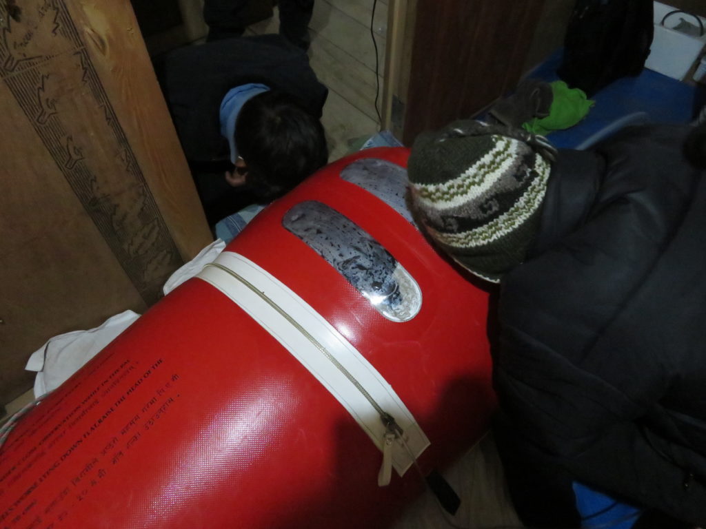
Someone happened to have a pulse oximeter, which we used to monitor the woman’s vital signs. Laura, an Australian outdoor education instructor who had been staying at the same lodge as the patient, was leading the response and had been keeping a written record of the pulse oximeter readings. Blood oxygen saturation had been at 31% for several hours. The signs, symptoms and context made it seem likely she was suffering from severe AMS, possibly with cerebral oedema. We were extremely concerned she would not survive the night if we did not get her medicine or to a lower altitude. We discussed making a stretcher to try and carry her through the night back down the valley, however decided against this as it put others at risk of injury. We knew that there was a clinic and a medic lower down the valley that might be able to help, so we sent word to send the medic up with any medicine he had.
Luckily, we eventually learnt that there was a lodge owner in our village who had a Gamow bag (a portable hyperbaric chamber, pressurised with a foot pump). The medic arrived and also had injectable dexamethasone, which was administered. Ryan bravely volunteered to get into the Gamow bag with the patient to ensure her airway stayed clear and to help report her vital signs to an observer outside the bag. Laura created a roster – we had volunteers do shifts, taking turns operating the foot pump to inflate and pressurise the Gamow bag, as well as to record the patient’s vital signs through the night.
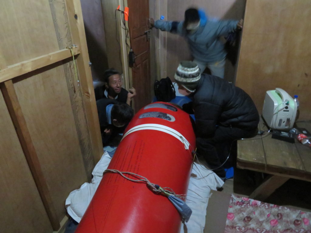

I was amazed and humbled at the eagerness of all the people present, both westerners and Nepalese, who had come from around the village and were unquestionable in their willingness to go without sleep and help in whatever capacity they could to keep the patient alive until the helicopter arrived. I was even more impressed with the heroism of Ryan and Laura, who did something more uncomfortable and grizzly than mountaineering that night. They took turns suffering inside the Gamow bag, trying to keep an unconscious (but moving and struggling) patient alive and reporting on her vital signs, getting covered in various bodily fluids in the process.
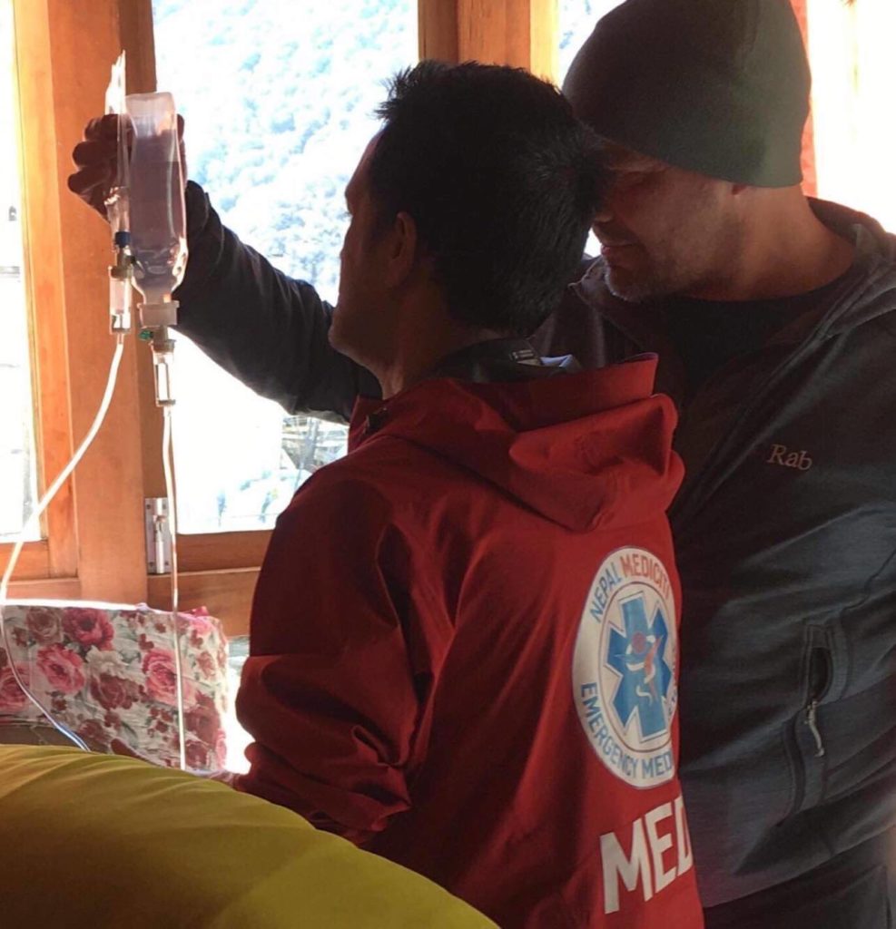
I did a two-hour stint recording the patient’s vital signs, between 12:30 and 2:30am. We used an altimeter to measure the effective altitude inside the Gamow bag. Encouragingly, the higher the pressure we maintained, the higher the patient’s oxygen saturation seem to read, which changed notably even over 15 minute intervals. We managed to get it above 50% with constant pumping.
A long night passed as we each did our shifts. At daybreak the patient was still unconscious but alive, thanks to the combination of the dexamethasone and Gamow bag. The foot pump eventually broke after over 6 hours of manual pumping. A helicopter arrived from Kathmandu at 8.30am, with medical staff who had plenty of bottled oxygen and other medicine. They managed to quickly get her oxygen saturation to 95% with their equipment. Eventually the patient was transferred to the chopper and taken to Kathmandu hospital, where it was found she had severe cerebral oedema. Exhausted after the stressful night, we washed ourselves up and went to the local café to debrief and recover with a much deserved day of rest.


3 – The Climb

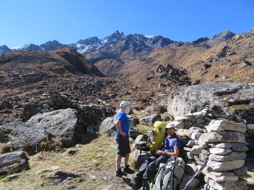
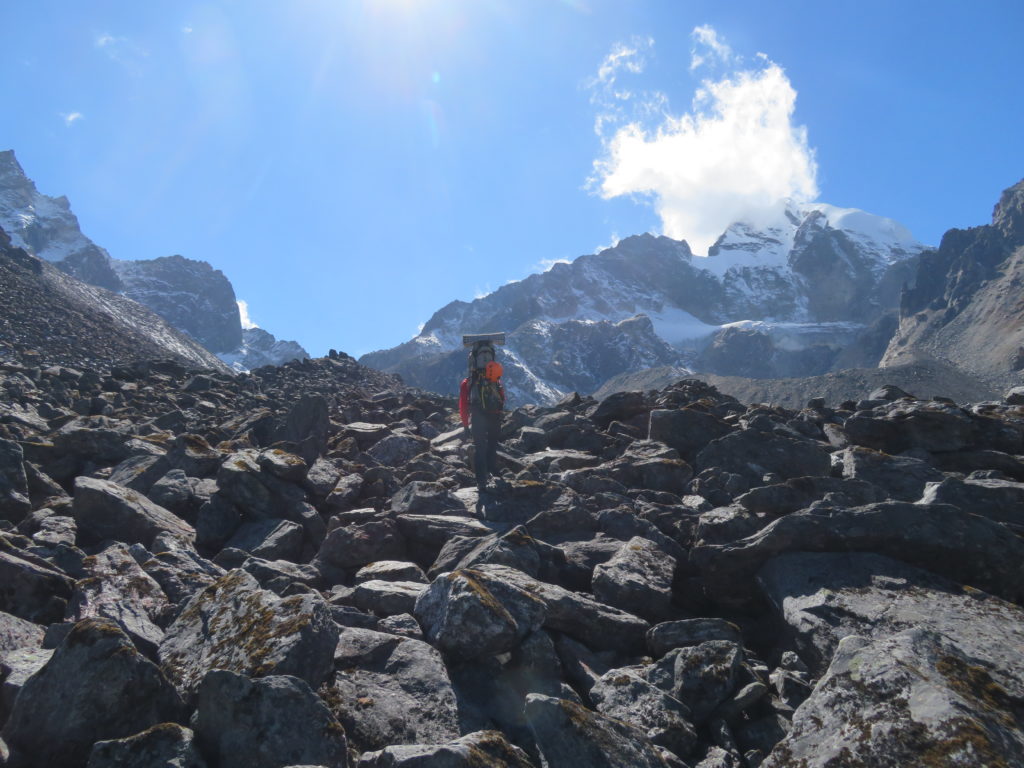
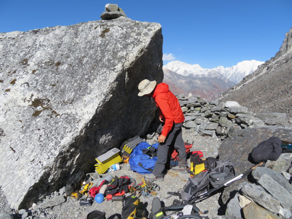
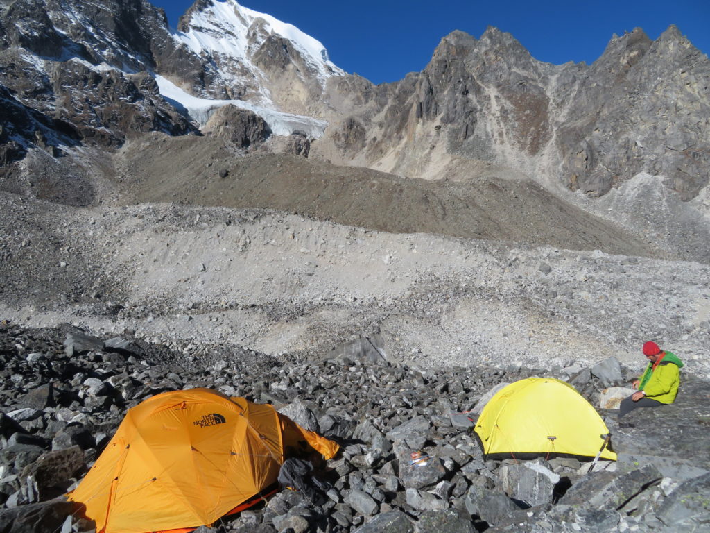
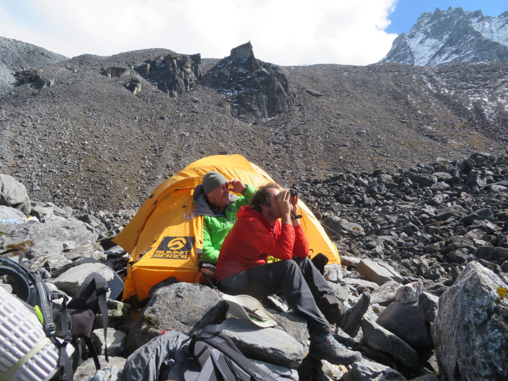
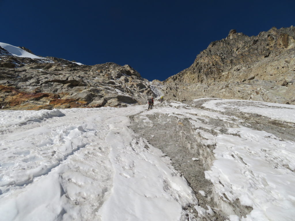
Following our rest day, we got some help from Sonam and Nurbu who carried 20L of water to our high camp with us. We carried any remaining gear and clothing we needed and established a camp for the next 3 nights. We had a rest day following our first night at high camp to allow time to acclimatise before our summit day attempt. We used this rest day to find a path through the glacial moraine to the base of the route, which we marked with cairns. We stashed our crampons and tools at the base of the route, to make the early glacial moraine crossing easier on summit day.


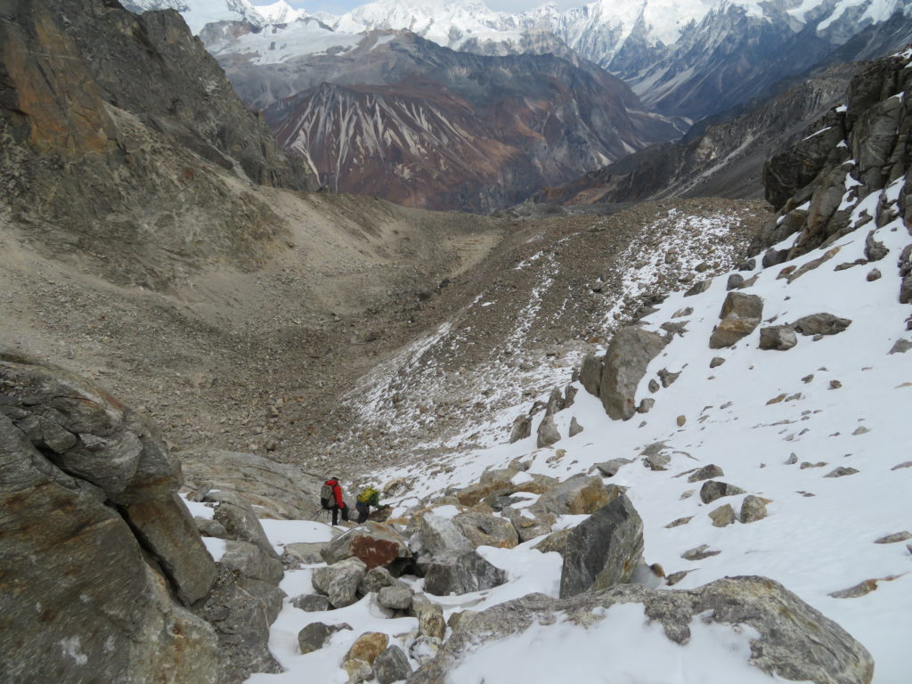
On summit day, we arose at 3am, and were walking by 3.30am. We quickly crossed the moraine, found our gear stash, put our crampons on and started climbing on the route as the sun was breaking.

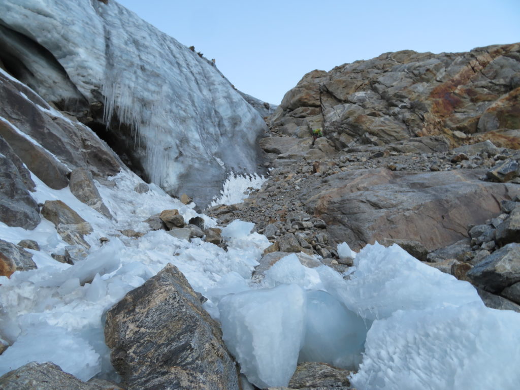
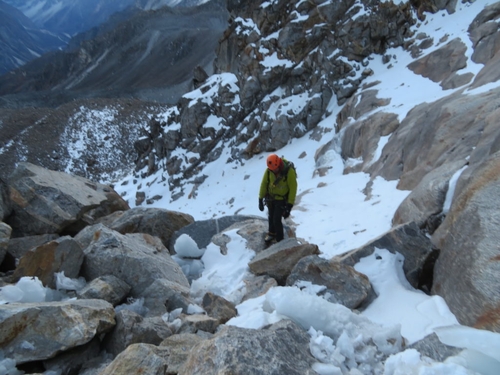
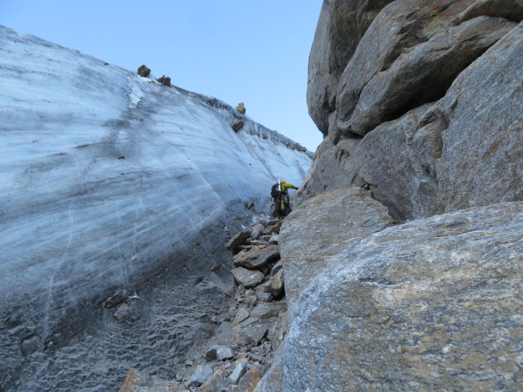
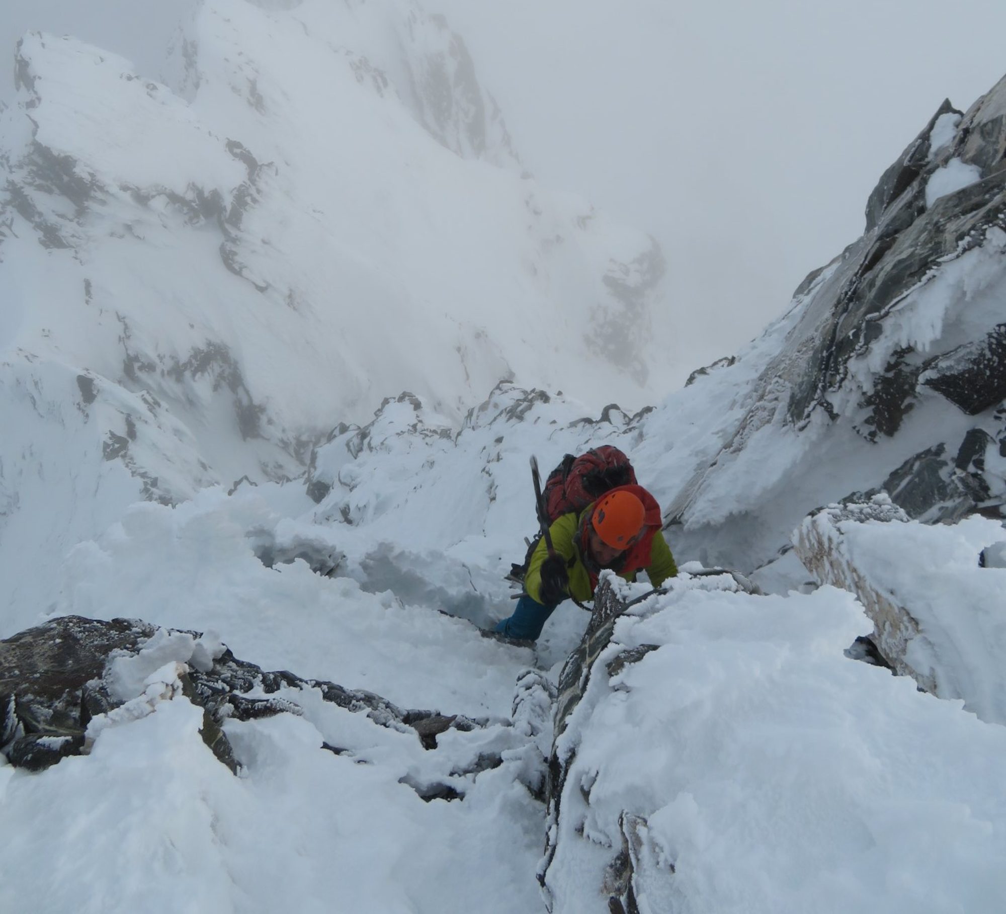
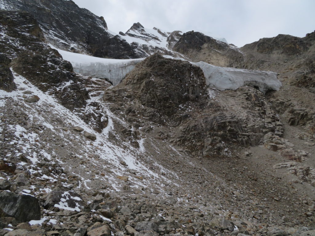
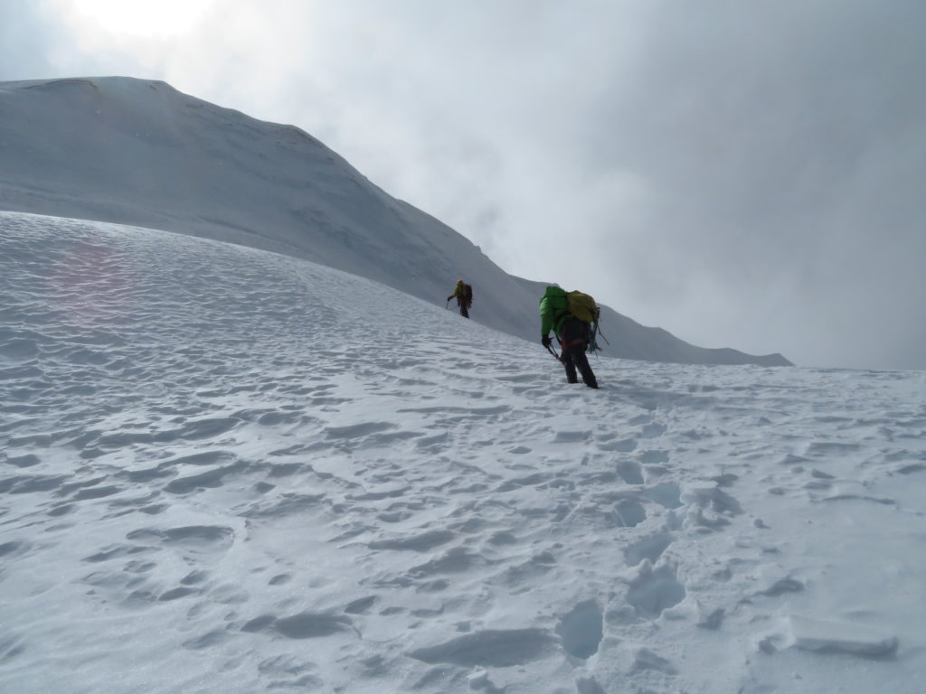
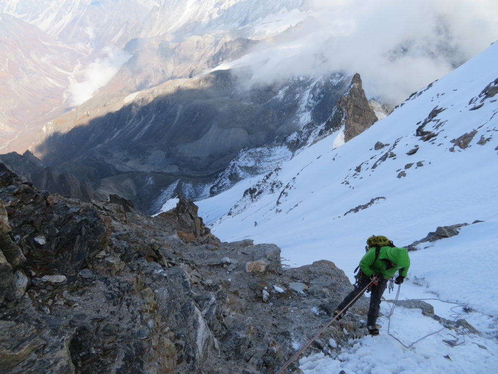
We ascended a natural gully that had formed between the main glacier shelf and a large rock buttress. On reaching the top of this gully, we easily soloed onto the névé. A leisurely stroll took us to an icy ramp that led up to the start of the crux of the climb, a ~40m section of ~WI2 alpine ice.


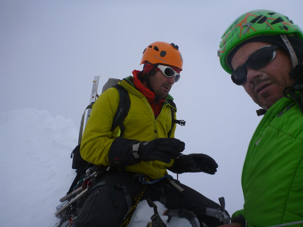
Ryan led the crux pitch, Rob and I both followed on separate ropes to speed things up. We then took the ropes off and continued soloing up the northeast face of Naya Kanga. Whilst the climbing was not technically hard and the weather was generally fine, the snow conditions were less than ideal: a thick, weak layer of crust that could not support our weight overlay a sugary layer of soft facets. We basically had to boot pack up two thirds of the mountain.


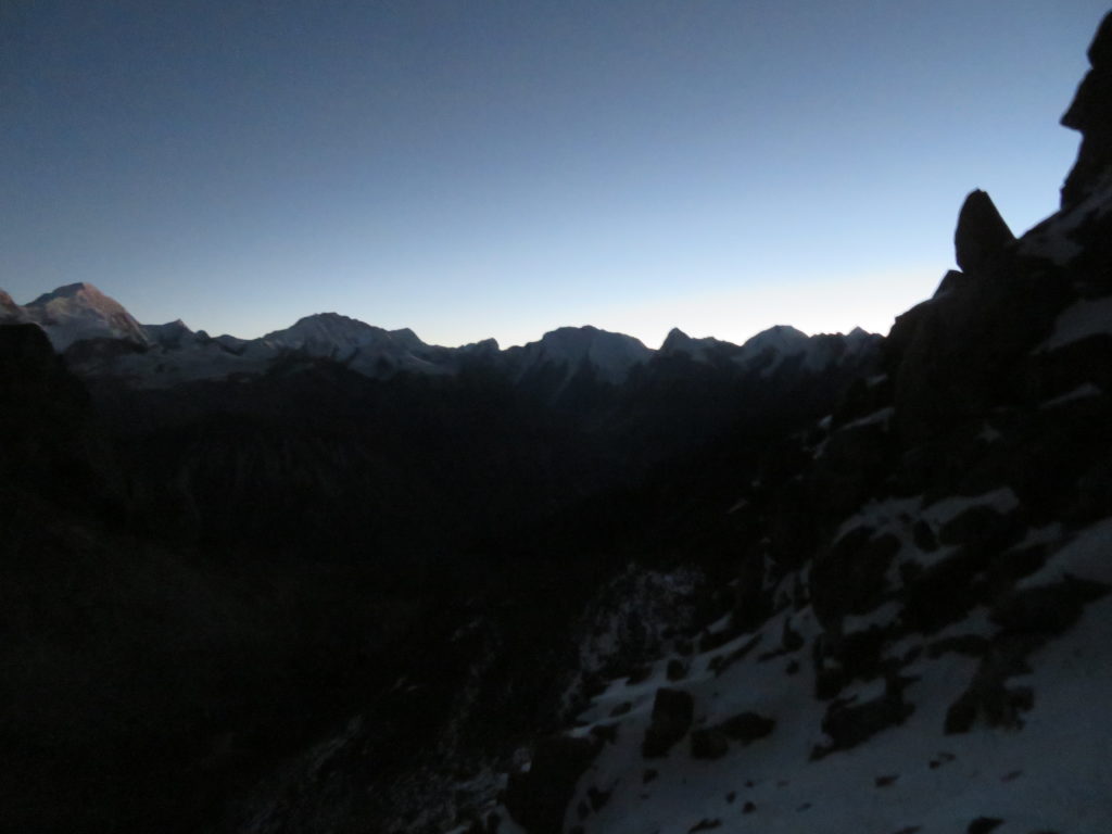
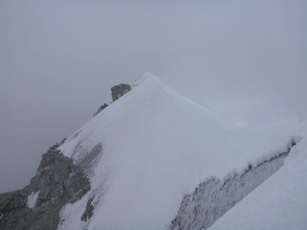
On approaching the summit, clouds started to enshroud the peak, and our views of the landscape were obscured by a sea of white. The temperature also dropped considerably as the sun disappeared and the wind started to increase. We managed to make it to the summit ridge at 1.30pm, but decided against traversing to the true summit (which was only 10-20m higher than our final position) due to dangerous cornices and it getting late in the day.


We started downclimbing as quickly as possible until we reached the first section of exposed rock that we could make an anchor on for abseiling. We abseiled approximately 16 pitches on double 60m ropes, a slow process that was very uncomfortable as we became more fatigued and the temperature began to plummet in the evening. We did however manage to catch a spectacular sunset from about halfway down the mountain. We left sacrificial cord and nuts behind as our abseiling anchors. Eventually we had used so much cord that we ran out and had to start cutting pieces off one of the ropes to make anchors. We got back onto terra firma well after night had fallen, which was a huge relief after over 7 hours of cold that had kept me constantly shivering. Our bodies were aching for a warm sleeping bag and hot drinks.
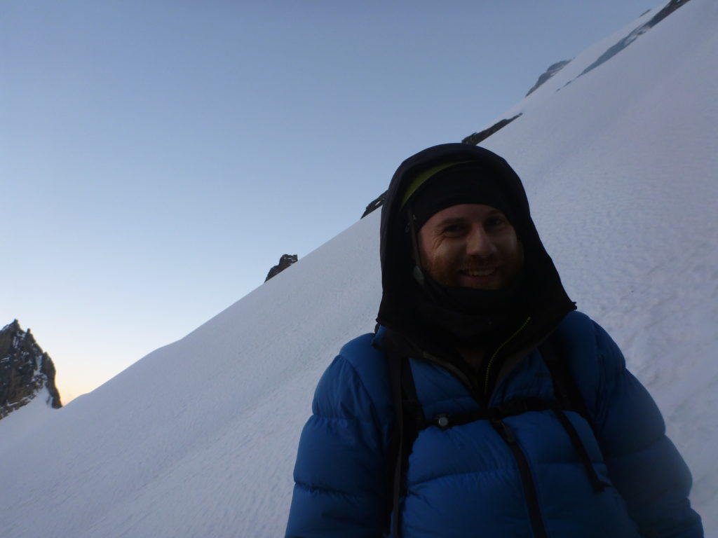

Another 2 hours of navigating back through the glacial moraine to reach our tents followed. My head torch battery went flat, however we had a full moon so I could still find my way through the night. We were so exhausted by this point that we could only walk for 15 minutes blocks before needing to rest. We got back to the tents around 1.30am, where we dived into our sleeping bags to try and get warm. We made a hot protein and rehydration drink, which was about all I could stomach. I was extremely dehydrated and had lost my appetite, despite having just burnt thousands of calories. The day’s effort had lasted approximately 21 hours. We were wasted, and we were exuberant.
4 – The Aftermath
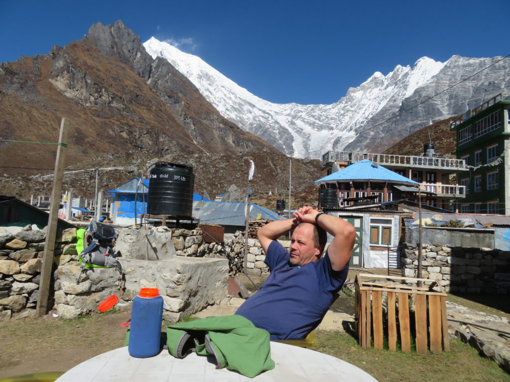
After finishing the climb and ferrying our gear back down to Kyanjin Gompa, we had a couple of easy rest days. We got word from Laura (who had returned to Kathmandu and was able to reach us via wifi) that the Finnish woman who we had helped was making a remarkable recovery in hospital, and was ready to be discharged. She was conscious and able to express gratitude for the first aid that had probably saved her life.
We used our time to talk to as many of some of the residents of the village about the situation with the lack of a clinic and decent medical supplies. Being such a remote and high altitude place, which has a constant stream of visitors from all over the world, it seemed likely that a similar emergency situation to what we had experienced could someday happen again. It was also possible that many Nepalese people living or travelling through the village were silently suffering from ailments that could be easily treated, yet there were no permanent facilities or people with the appropriate training who could help. We felt that having a small clinic with well trained medics, a Gamow bag and a decent stock of medicine and equipment could have enormous benefits for this community, which depends so much on tourism for its income. Such a project might also help raise the profile of this beautiful valley, and help to provide a safety net for unacclimatised tourists who get in trouble with acute mountain sickness. We talked about this almost non-stop for the remainder of the trip, and we were adamant that on getting home we would at least try and use whatever resources we had to help get the ball rolling.
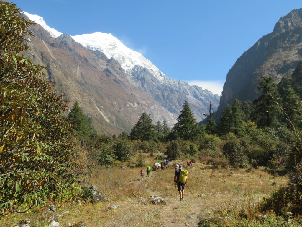
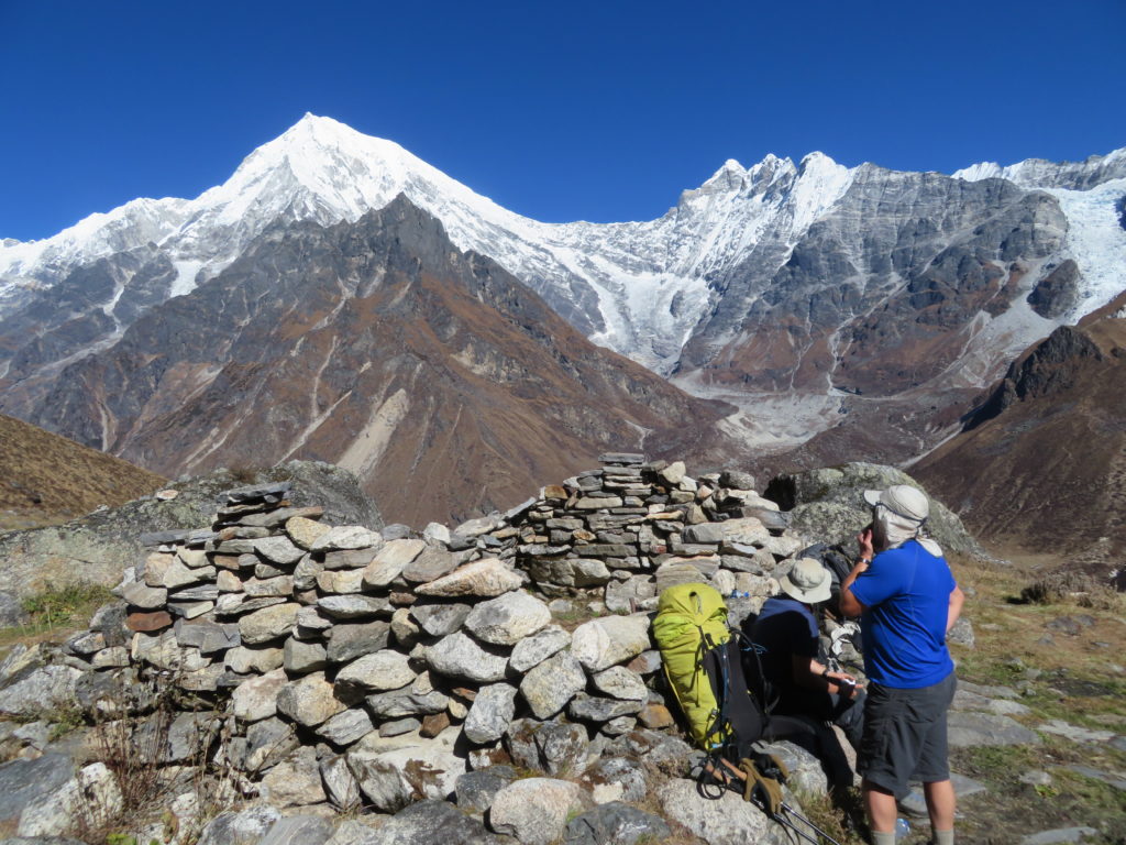
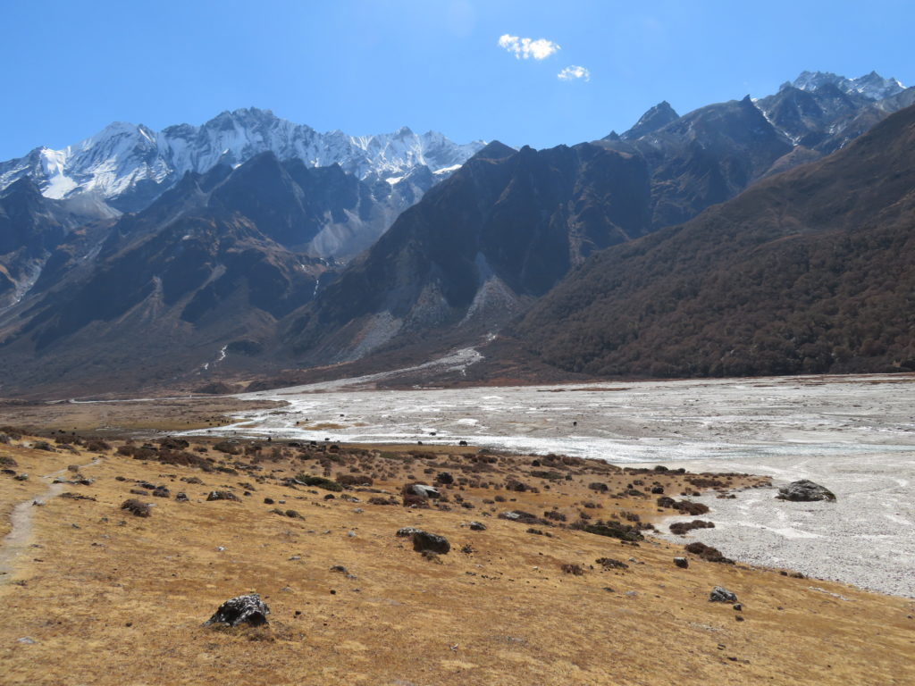
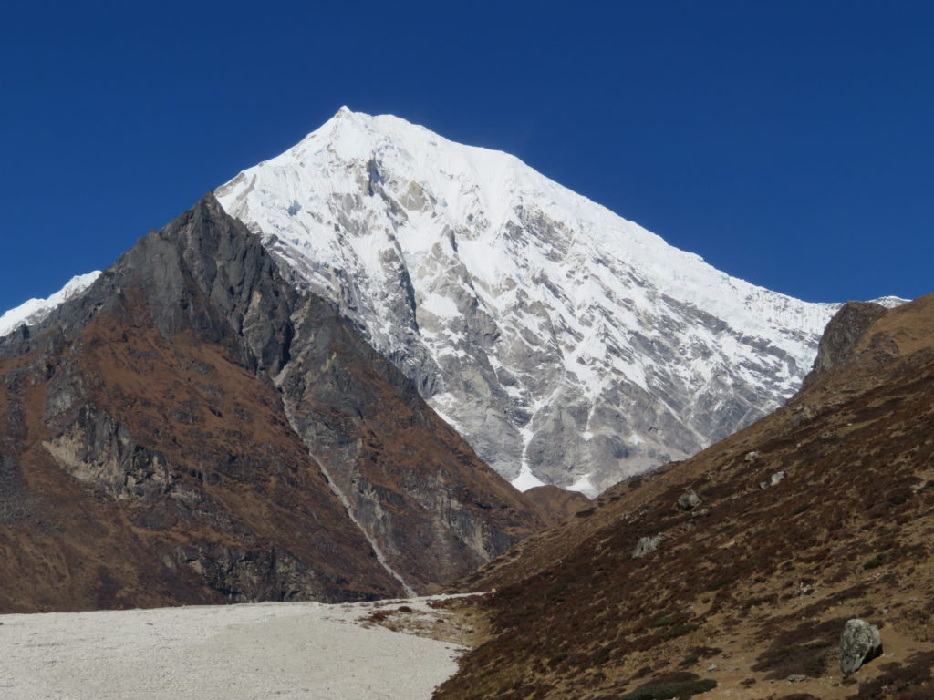
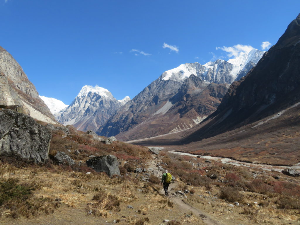
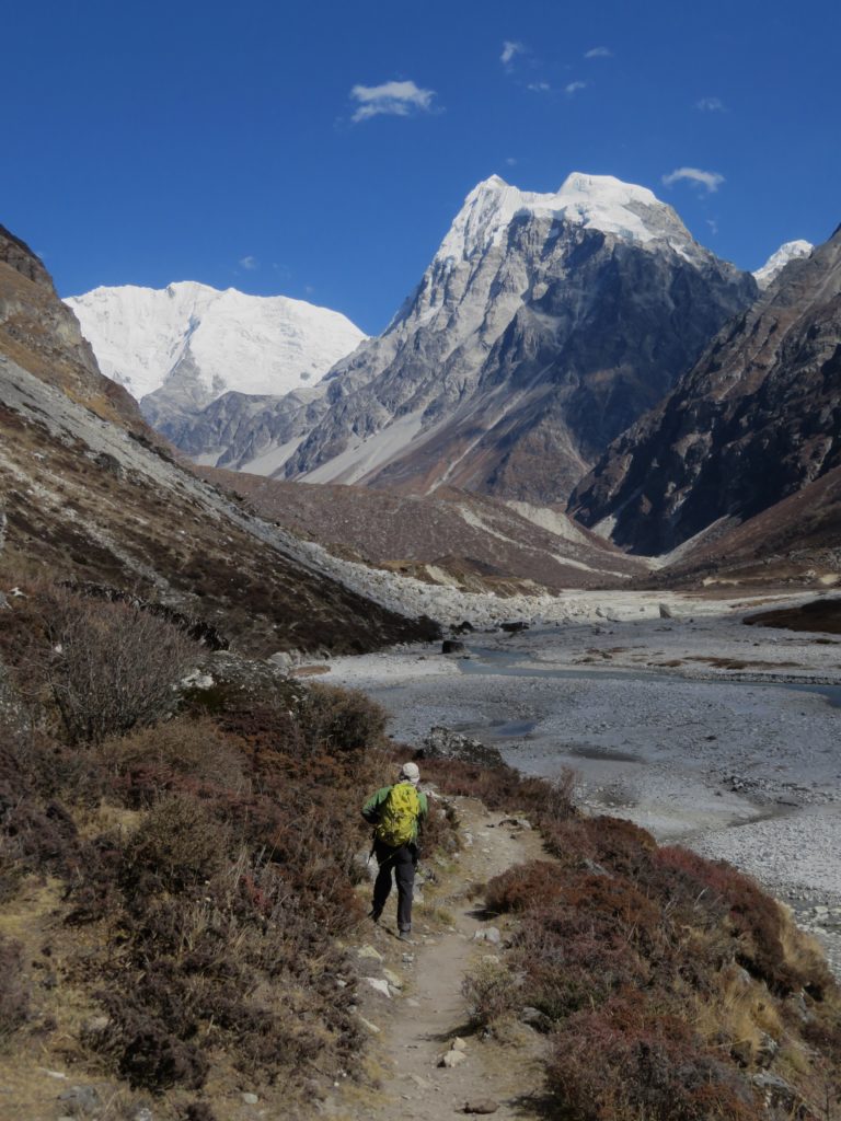
We spent one of our rest days going for a leisurely walk further up the valley. This was the most spectacular part of the area, and gave us clearer views of some truely magnificent peaks. Gangchenpo (6378m), Langshisa Ri (6560m), and Pemthang Karpo Ri (6865m) dominated our view to the east, whilst the giant pyramid of Langtang Lirung (7227m) dominated the skyline in the west. What we saw from our short stroll only scratched the surface. Hidden behind the peaks we could see exist dozens of peaks ranging from 5000 to 7000m, all of which would constitute serious undertakings with very long approaches to remote parts of the country, stretching all the way to the border with Tibet.


The Langtang Valley and Nepal have left me feeling enchanted, and looking forward to more adventures in the Himalaya and South Asia. There is so much potential for amazing and wild climbing, away from the crowds and the common trophy peaks. There are almost certainly dozens of forgotten 5000-7000m peaks which haven’t even seen a first ascent. Even the “trekking” peak of Naya Kanga, which was clearly visible from the tourist trail and had a moderately well beaten trekking path going past it, felt very isolated with next to no evidence that our route was often climbed.
Doing things the hard way, lightweight with minimal help from porters, climbing guides and fixed ropes, left us with an incredibly enriching life experience and made us all closer friends. We also made new friends from around the world, who we caught up with in Kathmandu before we left.
The people of Nepal are some of the warmest and most generous people I’ve ever met, incredible given they have so little compared to me and people from my country. The Langtang valley in particular, deserves to be visited more by climbers and trekkers, especially given how close it is to Kathmandu (Langtang Lirung peak is visible from the city). There is so much untapped potential, and the people, still recovering from the devastating 2015 earthquake, were so hospitable that I didn’t want to leave.