In May 2023, I travelled to Pakistan to join an expedition to attempt the as-yet unclimbed Kharut Peak II on the upper Godwin-Austen Glacier. The peak is approximately 6600m above sea level, and sits on the opposite side of the valley from K2 Abruzzi Ridge.
The expedition was lead by Luke Smithwick of Himalaya Alpine Guides. For me personally, this was my first foray into the world of expedition mountaineering.
Approach to Askole (3040m)
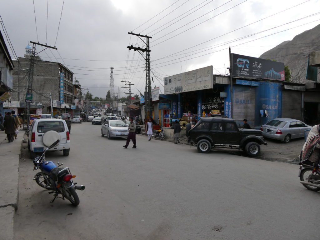
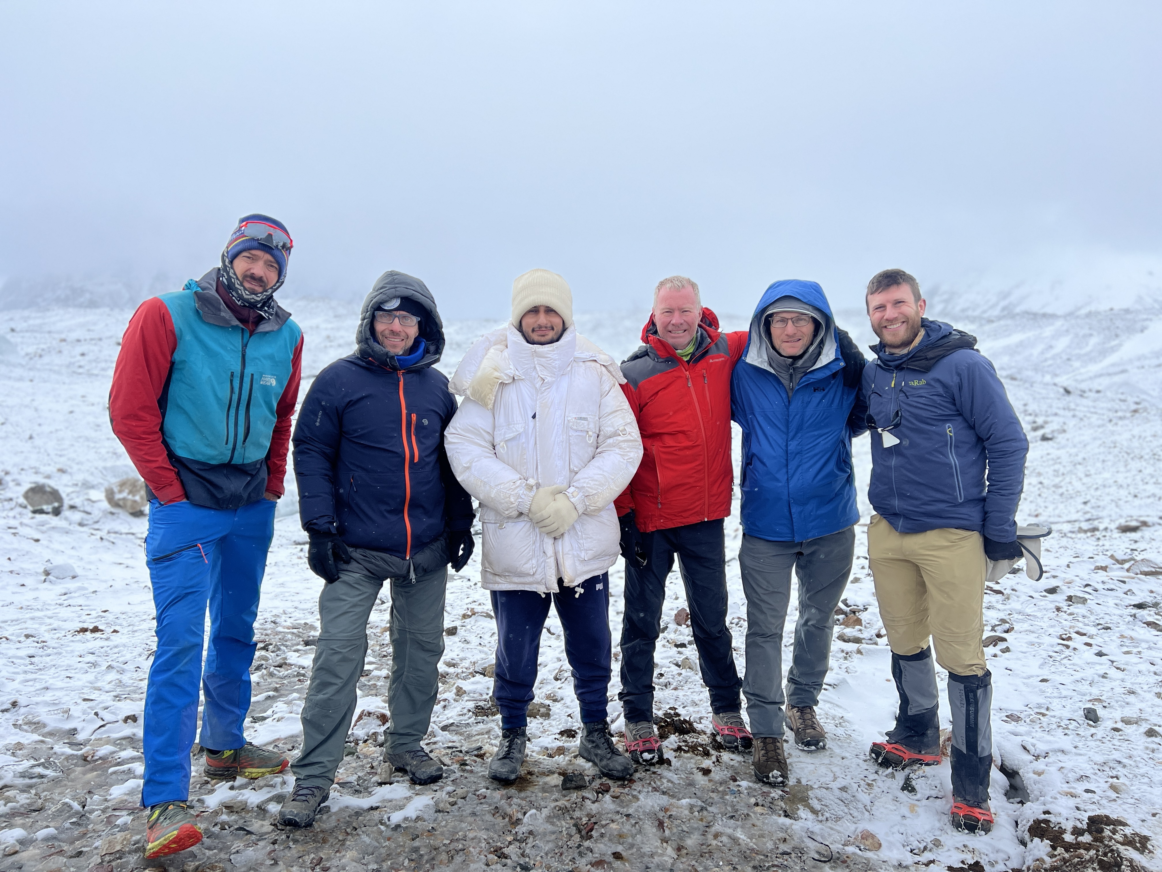
Landing in Islamabad on May 26, I met up with our guide Luke, as well as the other trip participants Tony (Sydney, Australia), James (Colorado, USA) and Ken (Virginia, USA). We stayed in a hotel in the ‘Blue Zone’ of Islamabad. We used the day to rest after our long flights, do a final gear check, and explore the local neighbourhood. Islamabad seems like a fairly quiet city, with plenty of diplomats and business people coming and going. Business don’t open until quite late in the day (11am), but at night the place lights up and becomes much more vibrant.
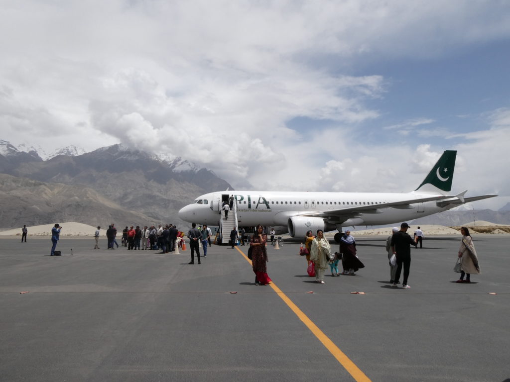
The following day we travelled to the airport to see if we could get a flight to Skardu. Flights from Islamabad to Skardu are frequently cancelled due to bad weather. We were prepared to get straight back into our vehicle and start driving the 20 hour journey to Skardu along the Karakorum Highway, if necessary. Thankfully, we had clear skies and we were able to fly to Skardu as planned with no delays.
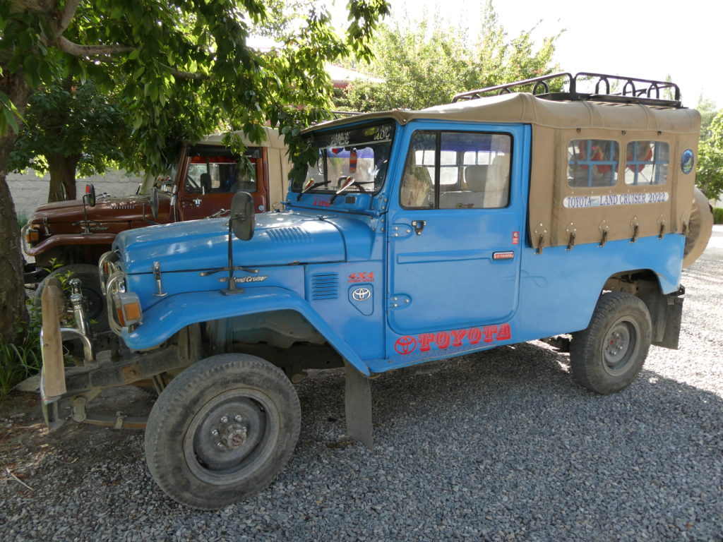
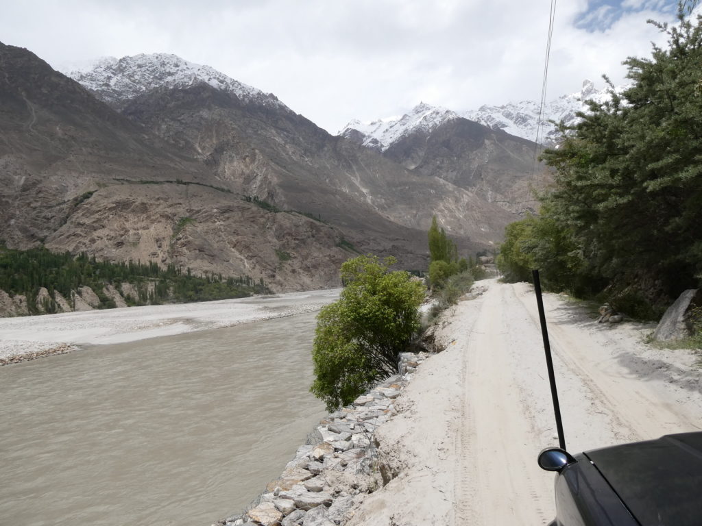
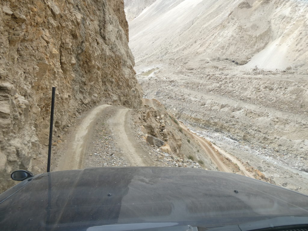
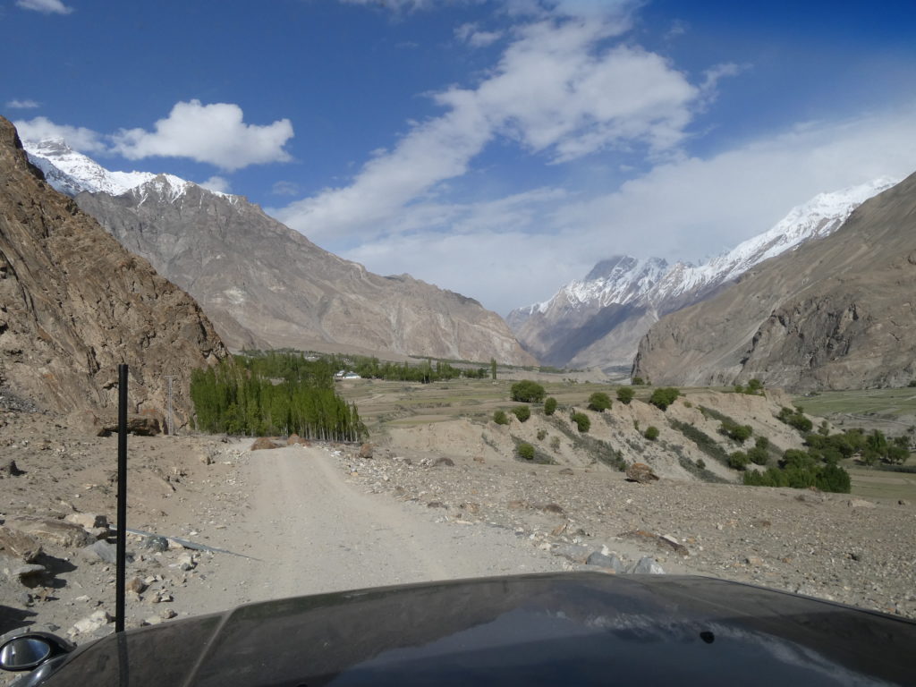
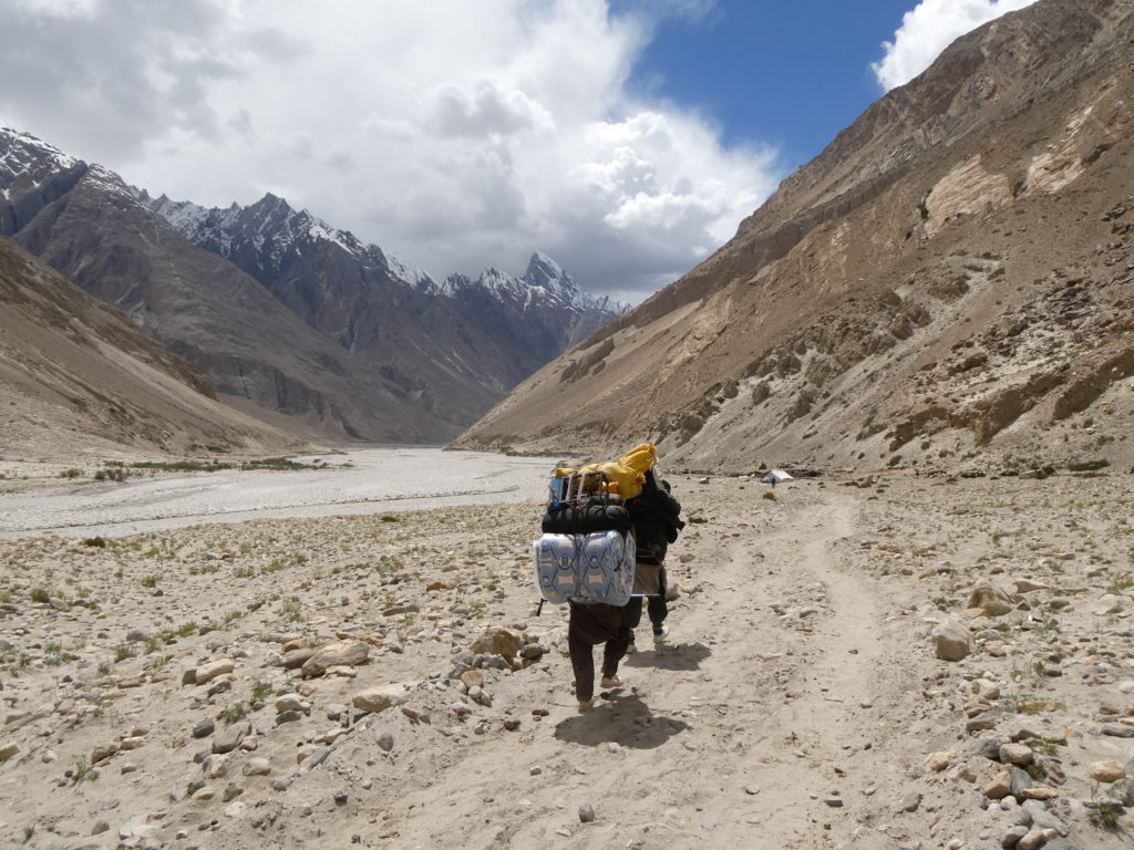
We were lucky to be able to sort out our permits within a day. We were able to begin the 6 hour 4WD journey to the high-altitude village of Askole the day after we landed in Skardu. We rode in Toyota Land Cruisers which have been used in the area for >20 years.
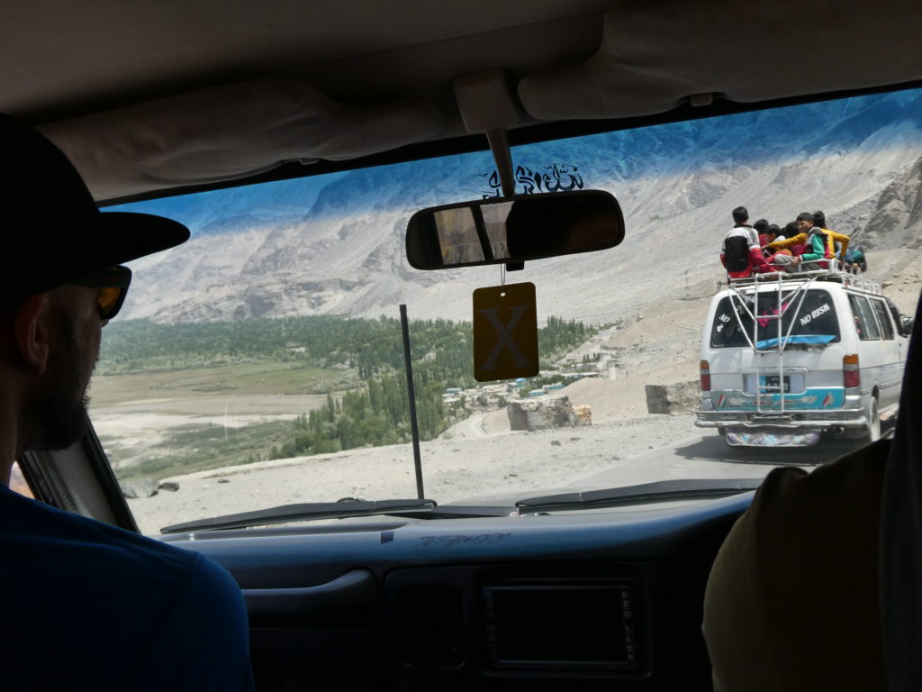
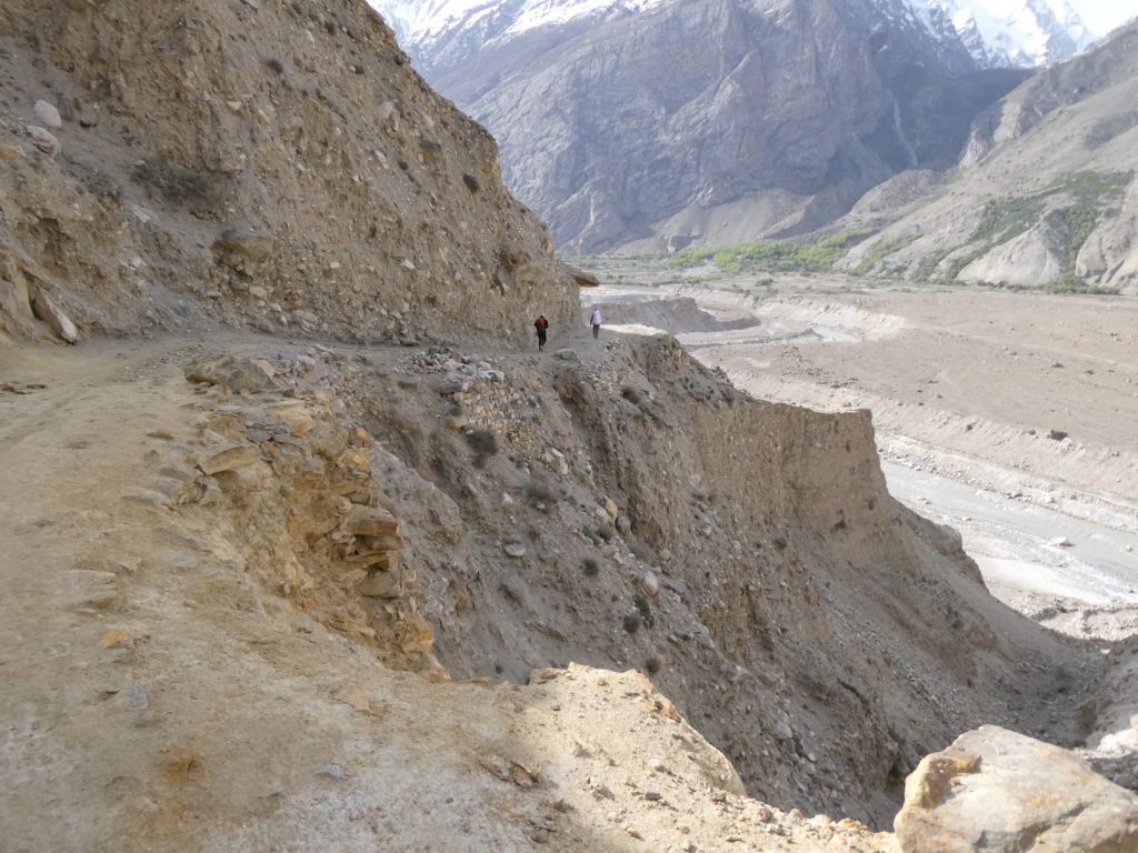
The drive to Askole followed the Indus River upstream to the confluence with the Shigar River, fed by the meltwaters of the Baltoro and Biafo Glaciers. The drive was spectacular, if a little nerve racking with the sheer drops beside the road. The area is essentially a desert, where very little grows except for the areas where humans have built irrigation systems that channel the glacial waters from the rivers. This gave the effect of little ‘Garden of Eden’ oases within the harsh desert landscape.
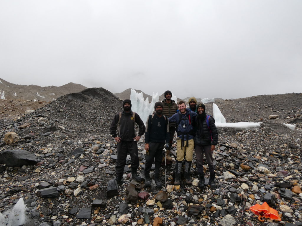
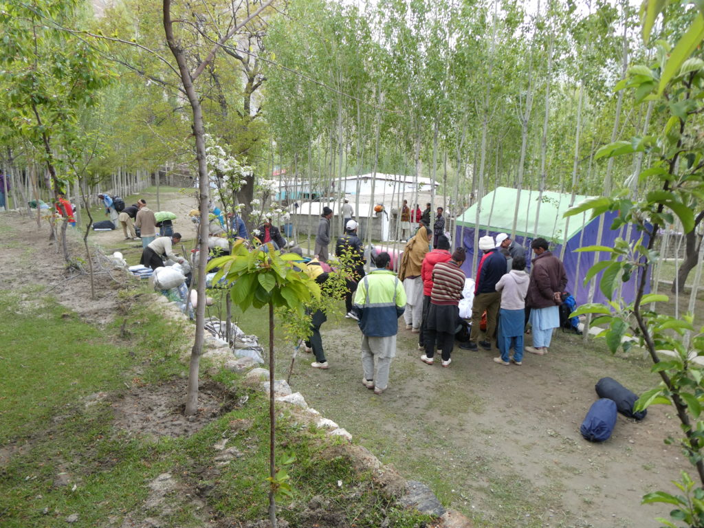
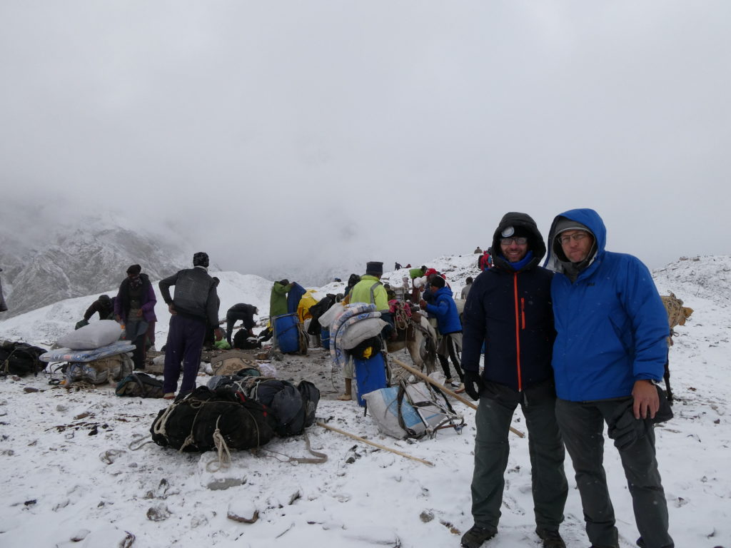
Arriving in Askole in the afternoon, we camped in tents which had already arrived in advance from Skardu. Our porters were all locals from this village, beyond which lay only wilderness and mountains. We also had a kitchen crew who prepared all our food for the expedition, and some Pakistani climbing staff who were there to help us establish high camps when climbing on the mountain. All up it made for a large contingent of ~35 people.
Approach to Base Camp (4980m)
Our approach to Base Camp along the Baltoro Glacier took 8 days. This was partially deliberate, to ensure we were always allowing time to acclimatise to the higher altitude as we ascended. However there were some unexpected logistical challenges which required us to spend more time than expected at certain locations. Our overall profile of ascent from Askole to Base Camp is shown below:
28 May – Askole – 3040m
29 May – Joula – 3140m
30 May – Paiju – 3400m
31 May – Urdukas – 4050m
1 June – Goro 2 – 4270m
2 June – Improvised camp between Goro 2 and Concordia – 4440m
3 June – Concordia – 4566m
4 June – Concordia (rest day) – 4566m
5 June – K2 / Kharut Base Camp – 4980m
The overall goal of the approach was to arrive at Base Camp injury free and with sufficient energy reserves to tackle our objective peak. The scenery on this trek is some of the most spectacular on Earth, passing by some of the world’s most dramatic peaks including the Trango Towers, Mitre Peak, the Gasherbrum Group, Broad Peak and of course K2. It was a worthwhile trek in its own right, and absolutely worth going slowly to enjoy the peace and scenery.
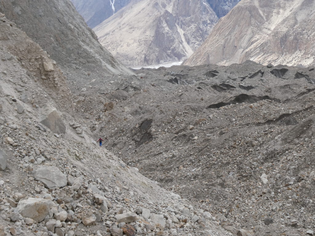
From Askole valley, the first two days were walking within a valley beside the Braldu river. An ancient glacially carved valley, most of the sediment we were walking on was compacted glacial till. The scale of the valley walls was hard to comprehend. ‘Minor’ peaks around us, that were not significant from an elevation point of view (i.e. <6000m above sea level) still appeared to be very prominent and potentially offered worthy climbing challenges. Even the moraine walls were several hundred meters high, bigger than most cliffs in my home country Australia.
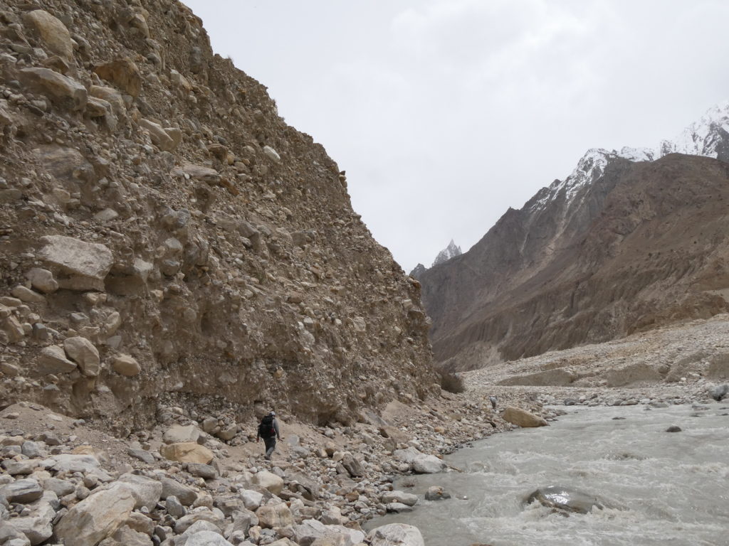
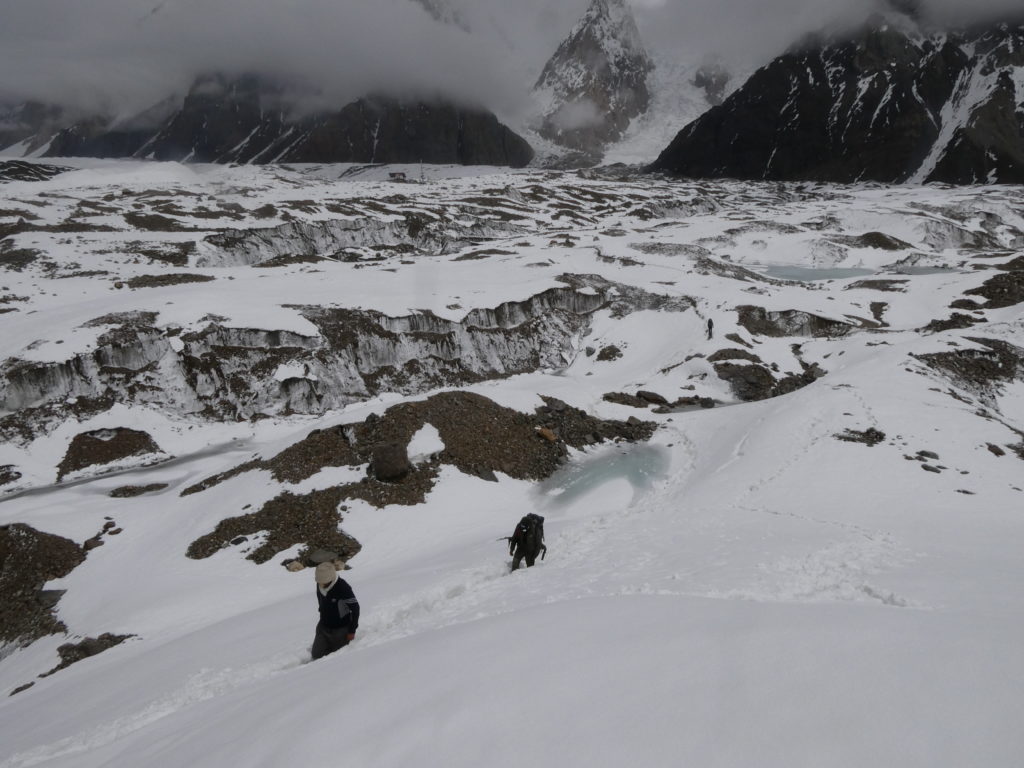
From Paiju, day 3 of our trek was the single biggest day of the approach. We crossed the ablation zone of the Baltoro Glacier and walked to Urdukas camp via the left lateral moraine. This day took ~10 hours of walking across rough scree, ice and piles of rock, with about 20km of distance and 700m of net elevation gain. At 4050m above sea level, I was feeling the altitude effects quite strongly at Urdukas and moved very slowly whilst walking. Urdukas is in an amazing position on the left lateral moraine of the Baltoro, and sits right across from the incredible granite spires of the Trango Towers. Unfortunately it was cloudy so our views of these peaks weren’t as clear as they could have been.
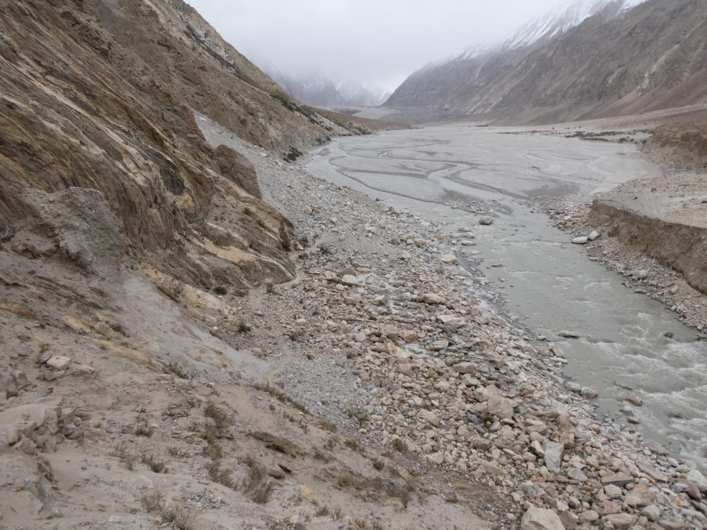
From Urdukas we then crossed into the centre of the Baltoro Glacier to approach Goro II camp. It began snowing as we walked, so shell jackets and the local trick of umbrellas came in handy for staying dry. Unfortunately, one of our party members James developed an inflamed knee and struggled to walk. Eventually he was in so much pain that he had to ride one of the mules, which our porters were using to transport equipment up the glacier. He made the tough call at Goro II to abort the expedition at this point, as to continue travelling further away from the road was only going to add risk to his own safety and to the success of the overall expedition. James’ brother Ken decided to accompany him back to Askole, using a mule to help transport James when he found it too painful to walk. I was very saddened to see James and Ken depart so early in the trip, but it was certainly the right call given the remoteness of where we were heading.
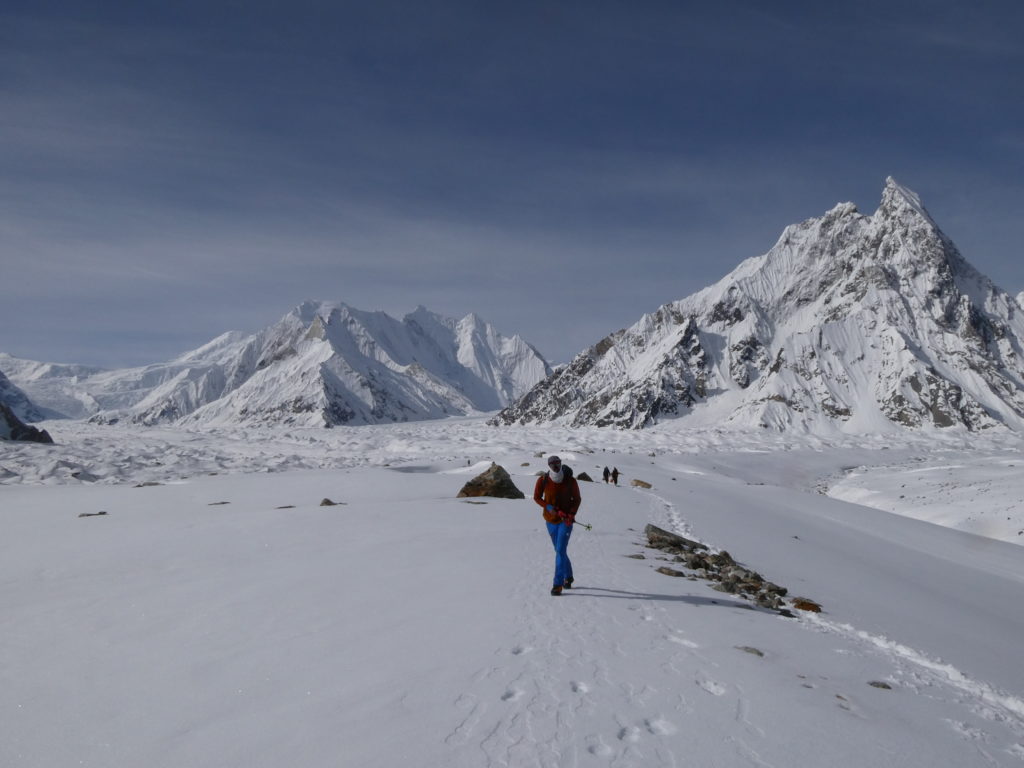
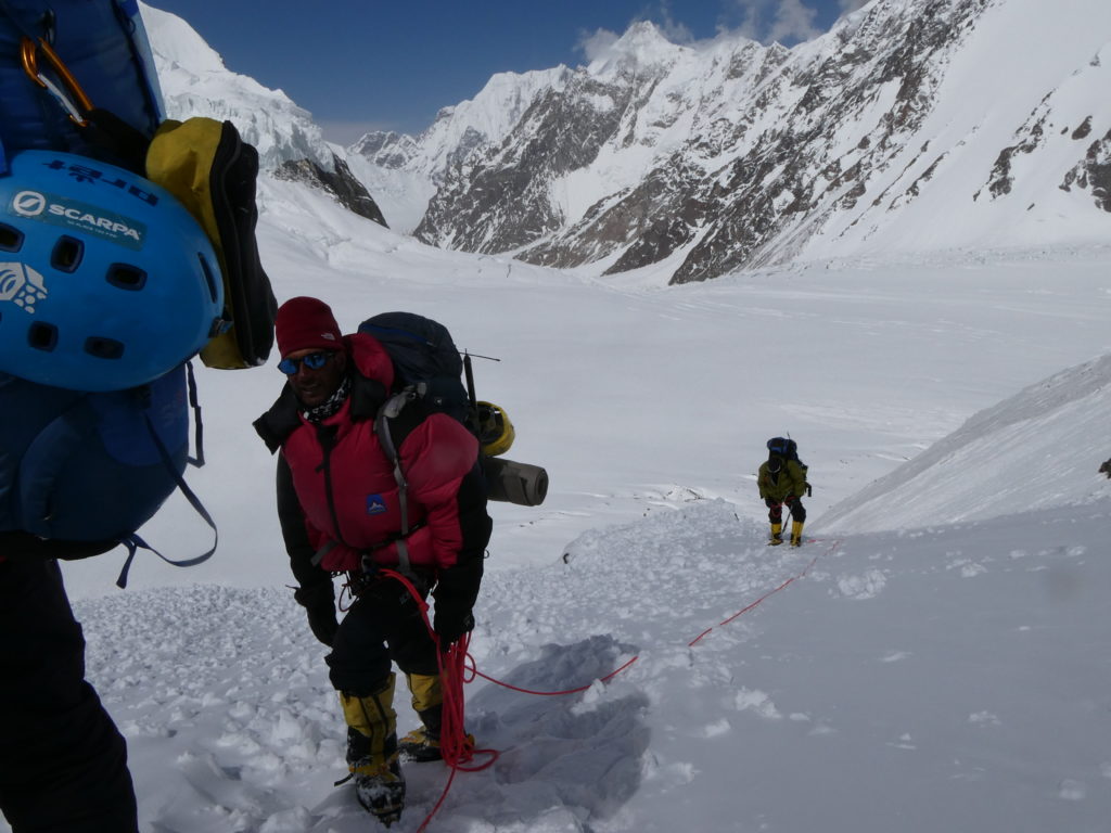
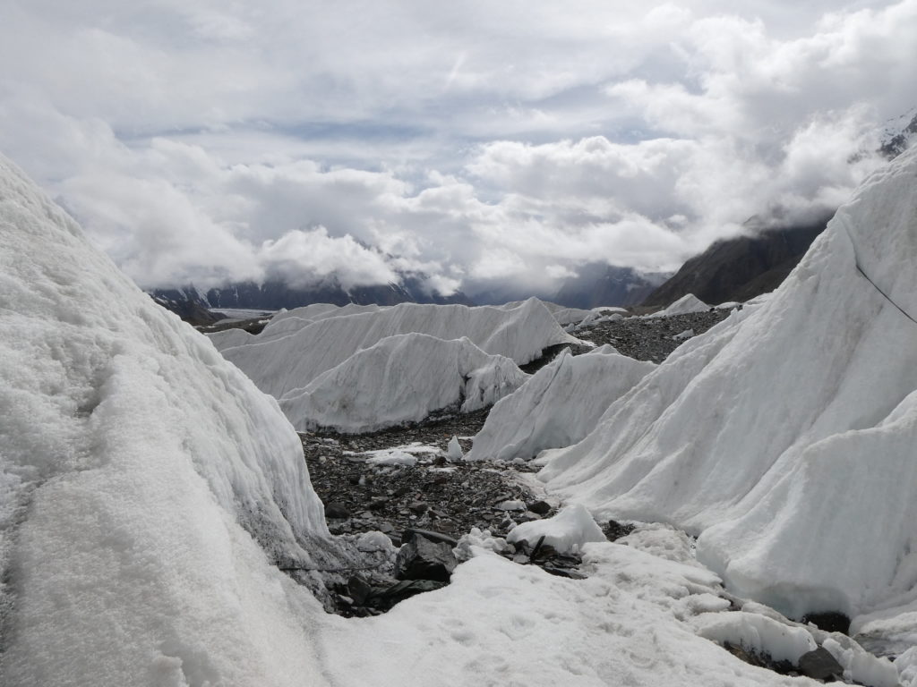
From Goro II, the porter logistics became more challenging, as the mules could not travel quite as far as Concordia due to the amount of snow. So we created an intermediate camp between Goro II and Concordia from which double ferrying of gear began on foot. It took 4 days to reach K2 Base Camp from Goro II, including one rest day at Concordia.
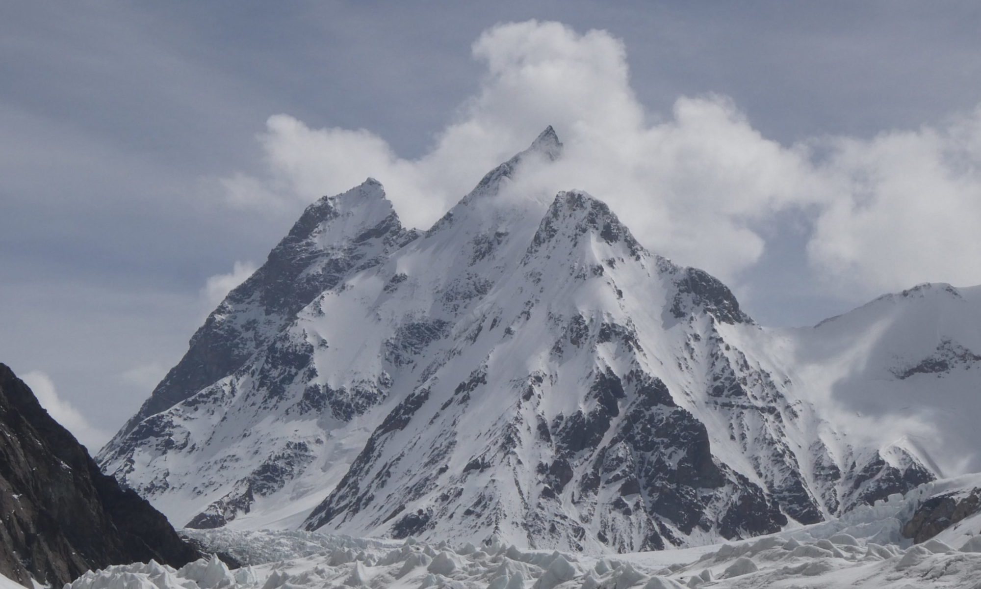
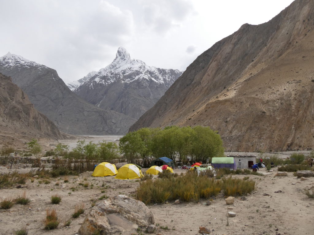
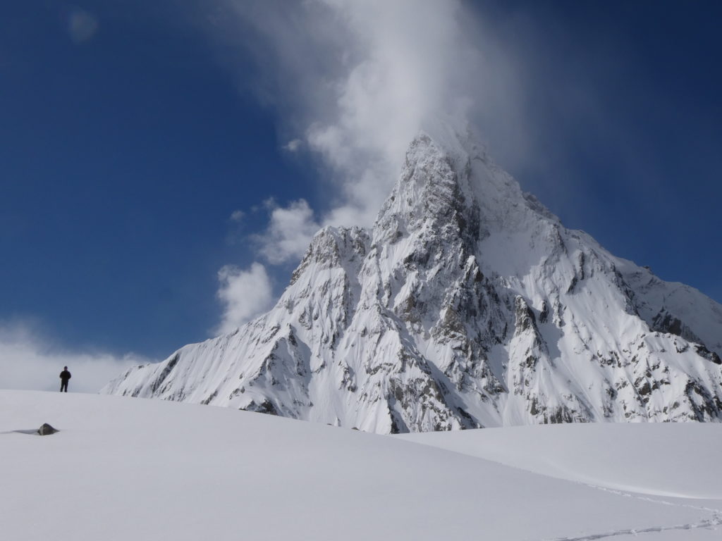
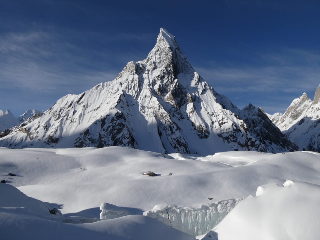
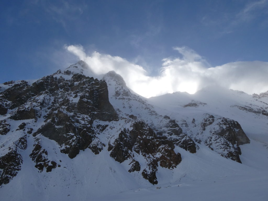
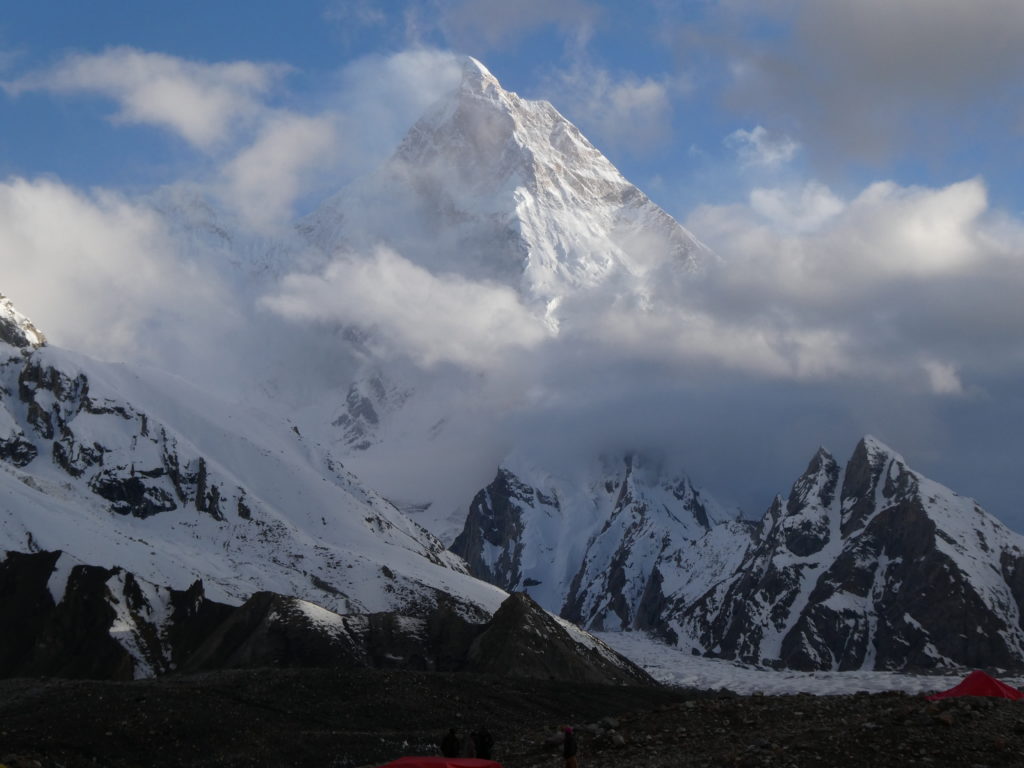
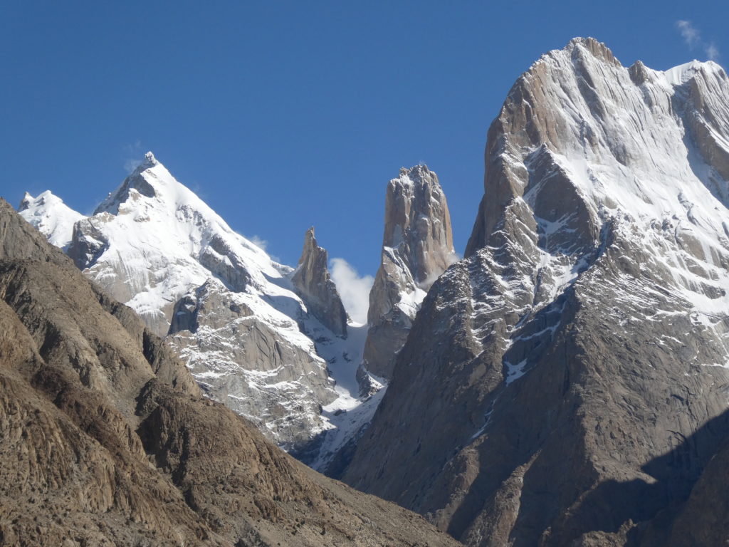
This section of the trek was the most spectacular, and is surely one of the most special places on the Earth’s surface. From Concordia (where the upper Baltoro Glacier and the Godwin-Austen Glacier converge), one can see four 8000m+ peaks, including Gasherbrum I and II, Broad Peak and K2. Other ‘minor’ peaks in the area are no less impressive. I was particularly besotted by the impregnable-looking Mitre Peak (6010m), which rose up like a fang from beside Concordia. Apparently this peak has only had one (disputed) summit in climbing history. There are certainly many unsolved climbing challenges in the Upper Baltoro and Godwin-Austen glacier.
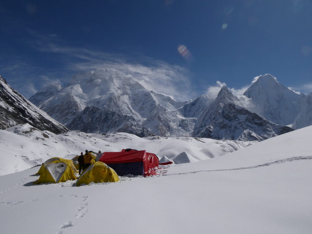
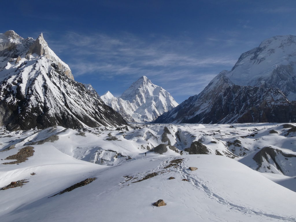
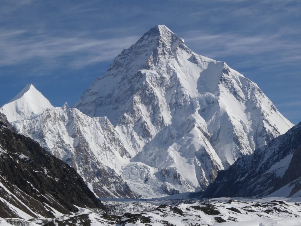
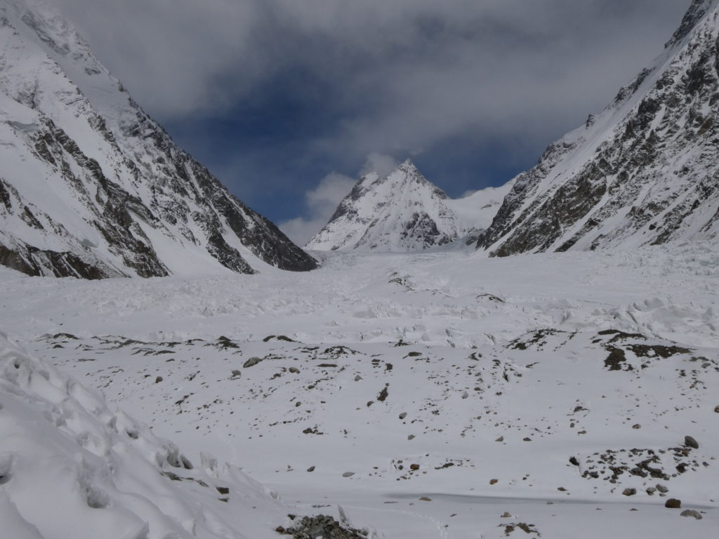
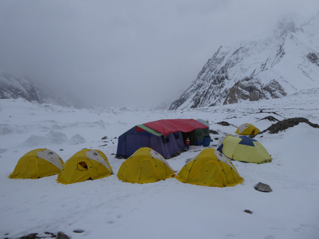
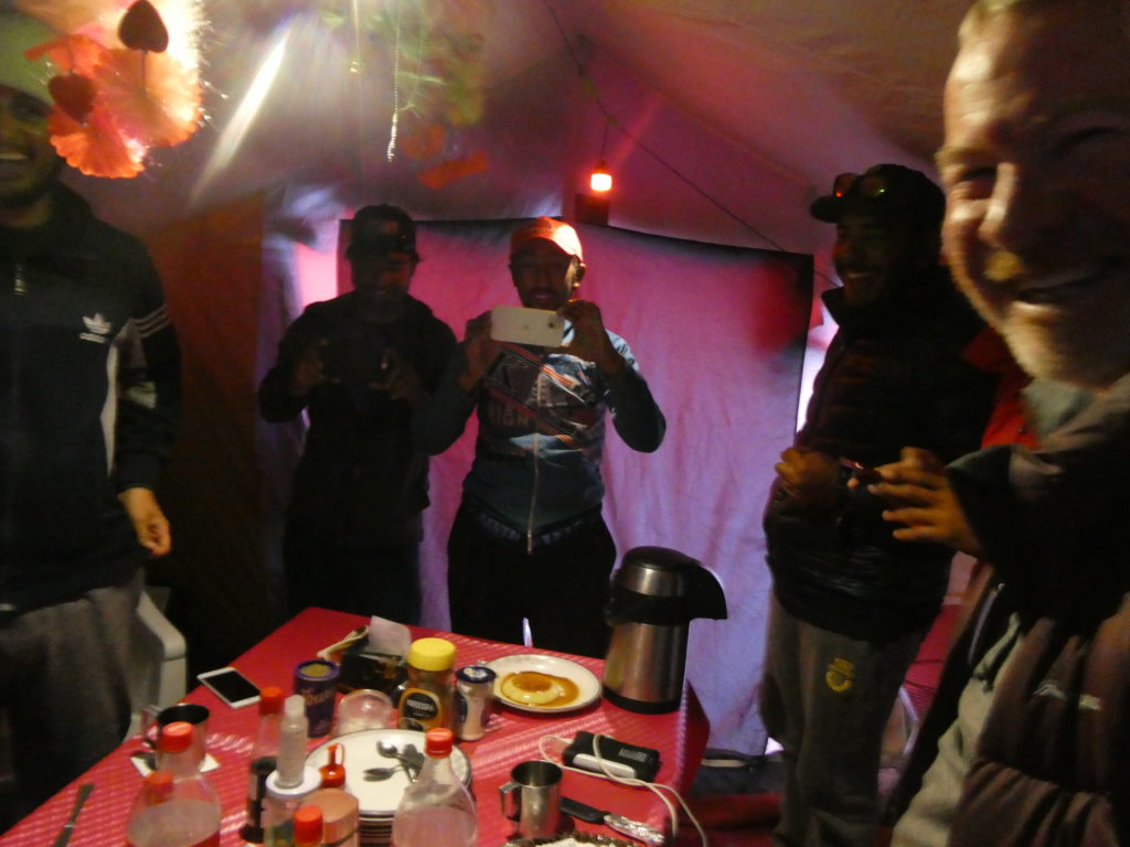
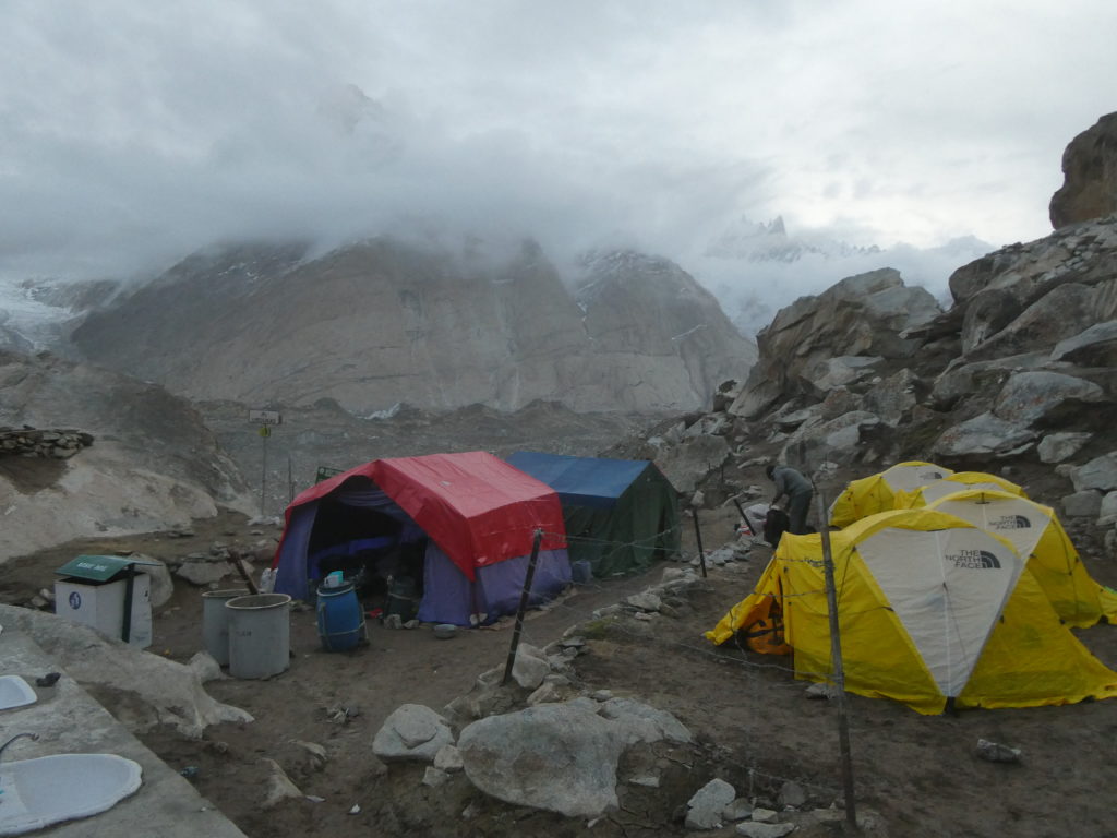
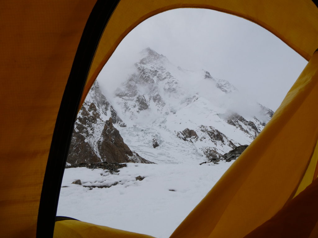
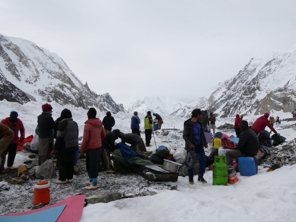
We decided to make K2 Base Camp our main base for Kharut II. Even though Kharut II lay a further 6km up the Godwin-Austen glacier, the way was heavily crevassed from this point on, so for regular porters it was too dangerous to expect them to continue ferrying food and equipment beyond here. At this point we rested for several days and began our program of acclimatisation for the objective peak. We were the only party present at K2 Base Camp (and the entire upper Baltoro area for that matter…) for the entirety of our time there, which was incredible given the number of people who would be coming here later in the season. The peace, silence and beauty of the place was special.
Kharut II Climbing
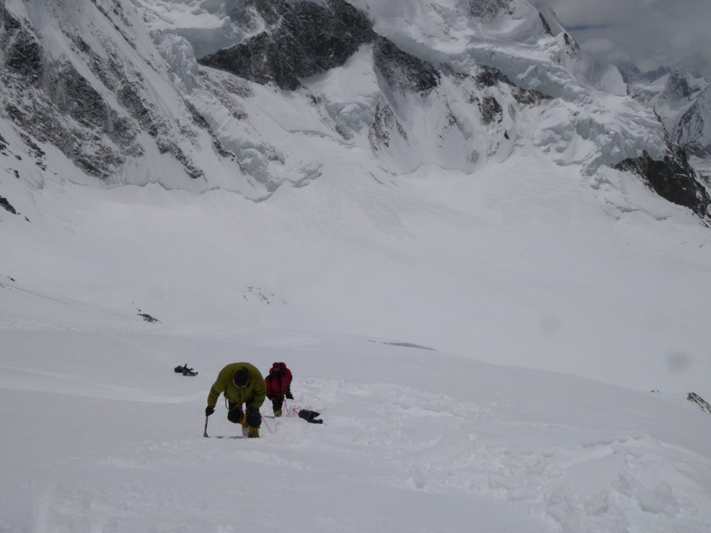
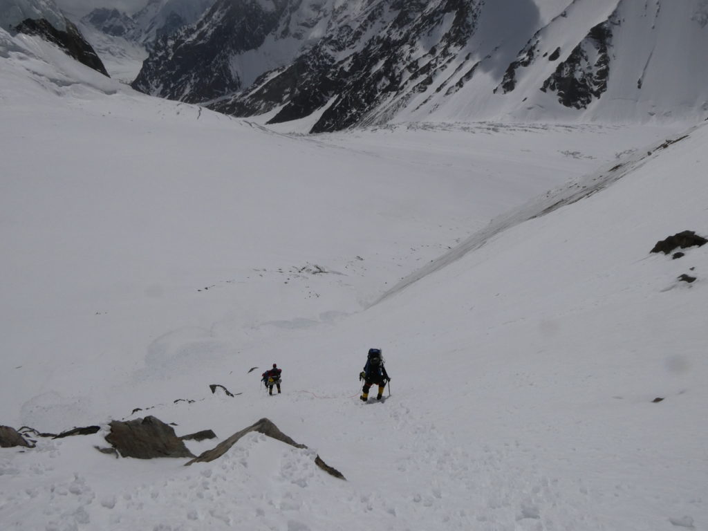
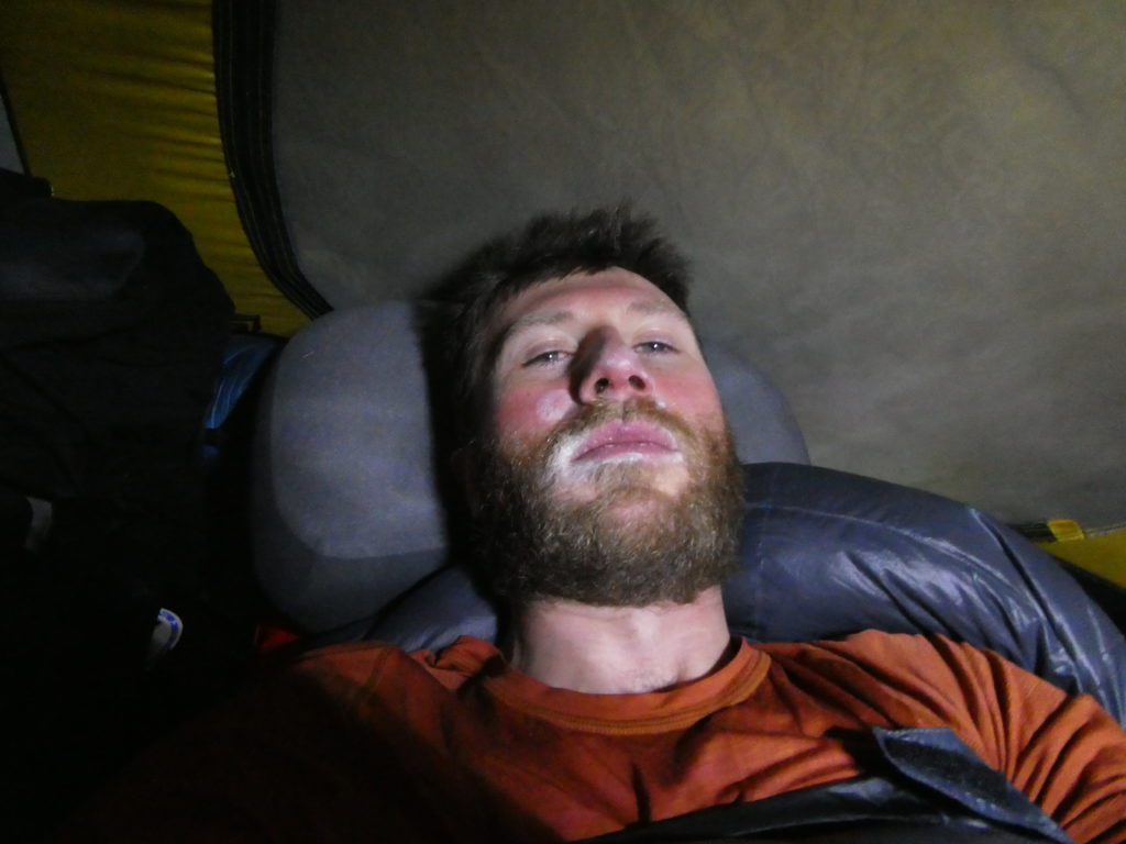
From our Base Camp at the bottom of K2, we began the processes of ferrying gear 6km further up the Godwin-Austen glacier to establish an Advanced Base Camp at the base of Kharut II. The first ferry was a gear dump followed immediately by return to Base Camp, to give us some exposure to the higher altitude and chance to recover at a lower altitude. I missed this rotation due to contracting Giardia, which required a hefty dose of antibiotics and 2 days of rest to recover.
I never really felt completely acclimatised at K2 Base Camp – at ~4980m above sea level, I tended to feel fairly breathless from simply walking between tents, even just before we departed at the end of our time there. The weather at Base Camp was generally sunny or partly cloudy, with no or very light winds. The temperatures would swing rapidly between 33°C at midday with full sun, to ~0°C when clouds blocked the sun, to approx. -15°C overnight (given clear skies).
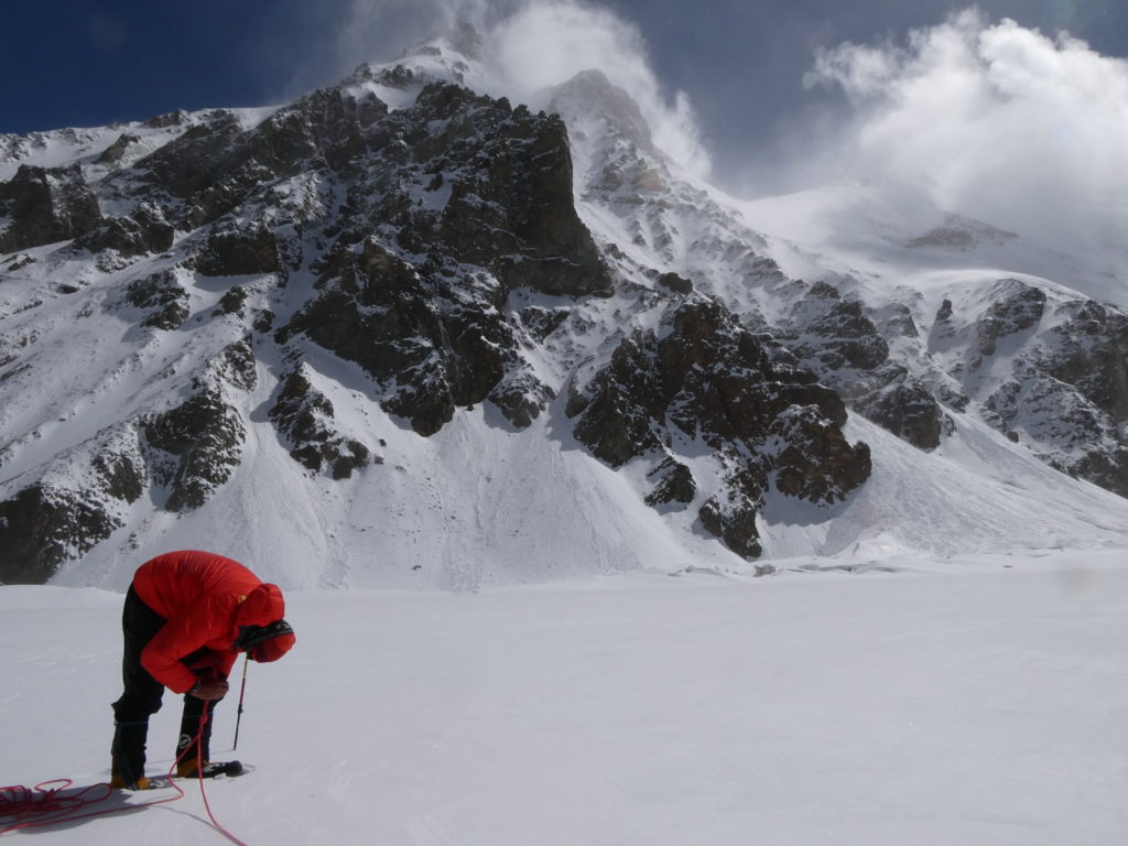
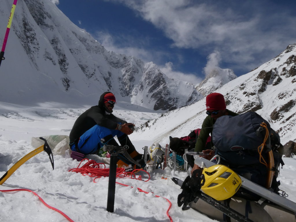
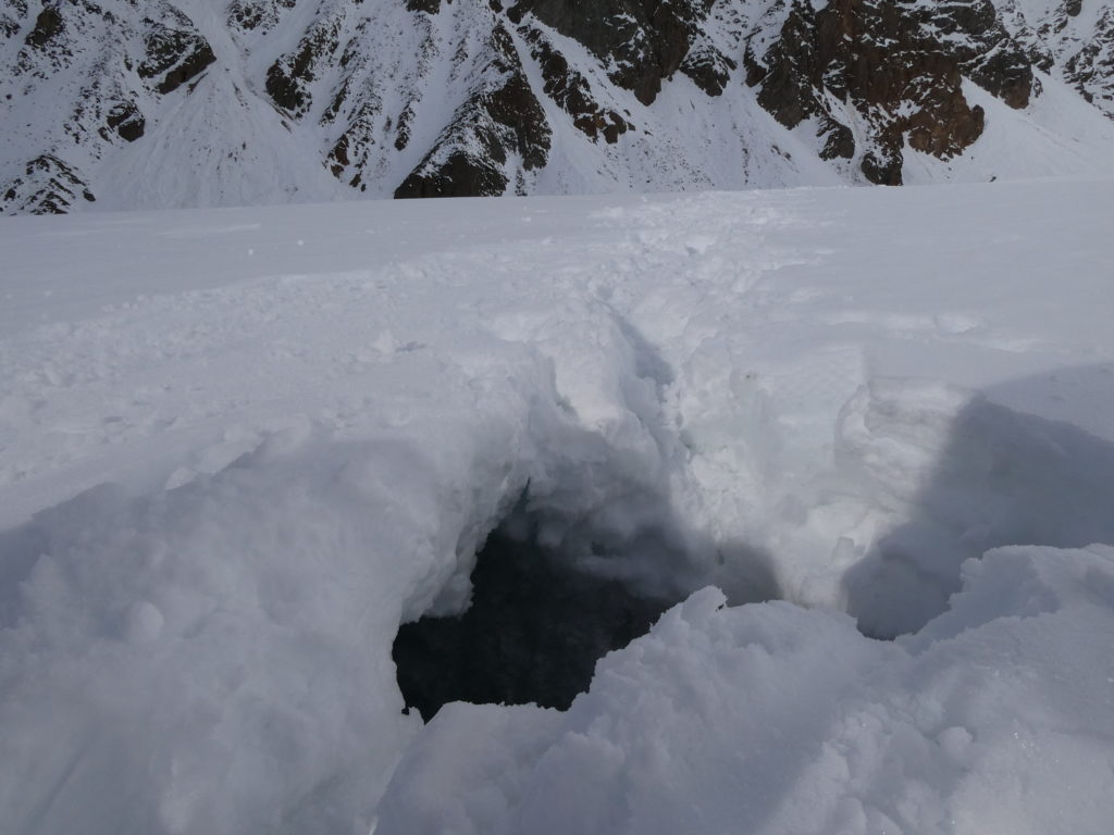
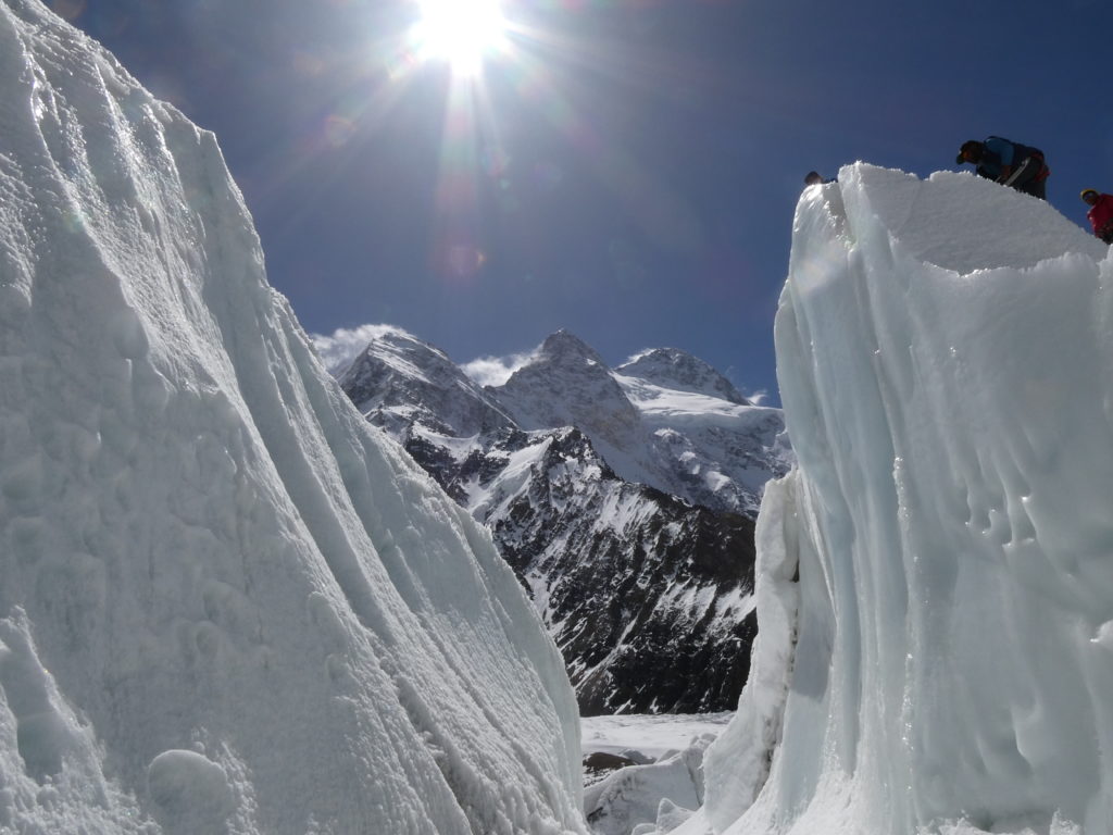
After the first rotation, we were fortunate to have a 3-4 day weather window, according to forecasts which Luke was receiving via his Garmin InReach. On Friday June 9, we had a very early start (3am breakfast) and made our way to our gear dump during the coldest part of the day, to ensure the snow was as frozen solid as possible. It was bone-chillingly cold, but easy walking given how compact the snow was. Despite this, we still managed to have Tony fall into a crevasse about 15 minutes before we reached our Advanced Base Camp. We were roped up and he only fell up to his waste – I was able to drag him out by his pack.
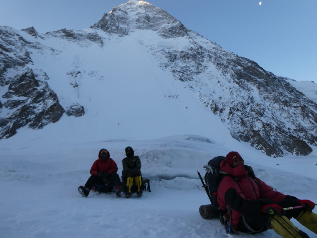
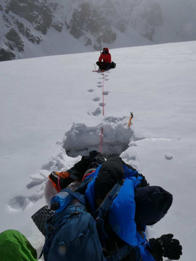
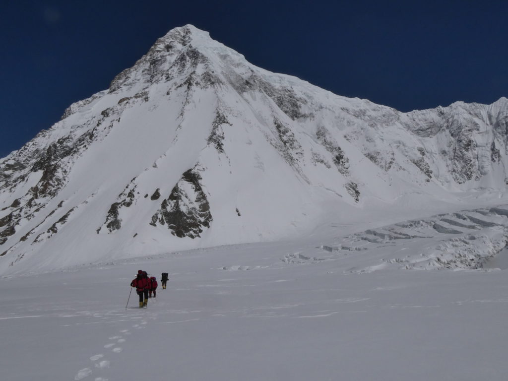
It took approximately 5.5 hours to reach a flat spot beneath Kharut II that was sufficiently far away from avalanche runout zones, where we established our Advanced Base Camp. At this point, Tony made the call to return to Base Camp, as he was not feeling well enough to continue due to the altitude (~5500m at ABC). Luke and I put up 2 tents, one for us and one for our Pakistani climbers, who accompanied Tony back down to the safer part of the glacier and then continued ferrying gear from the gear dump location about 2km down the hill.
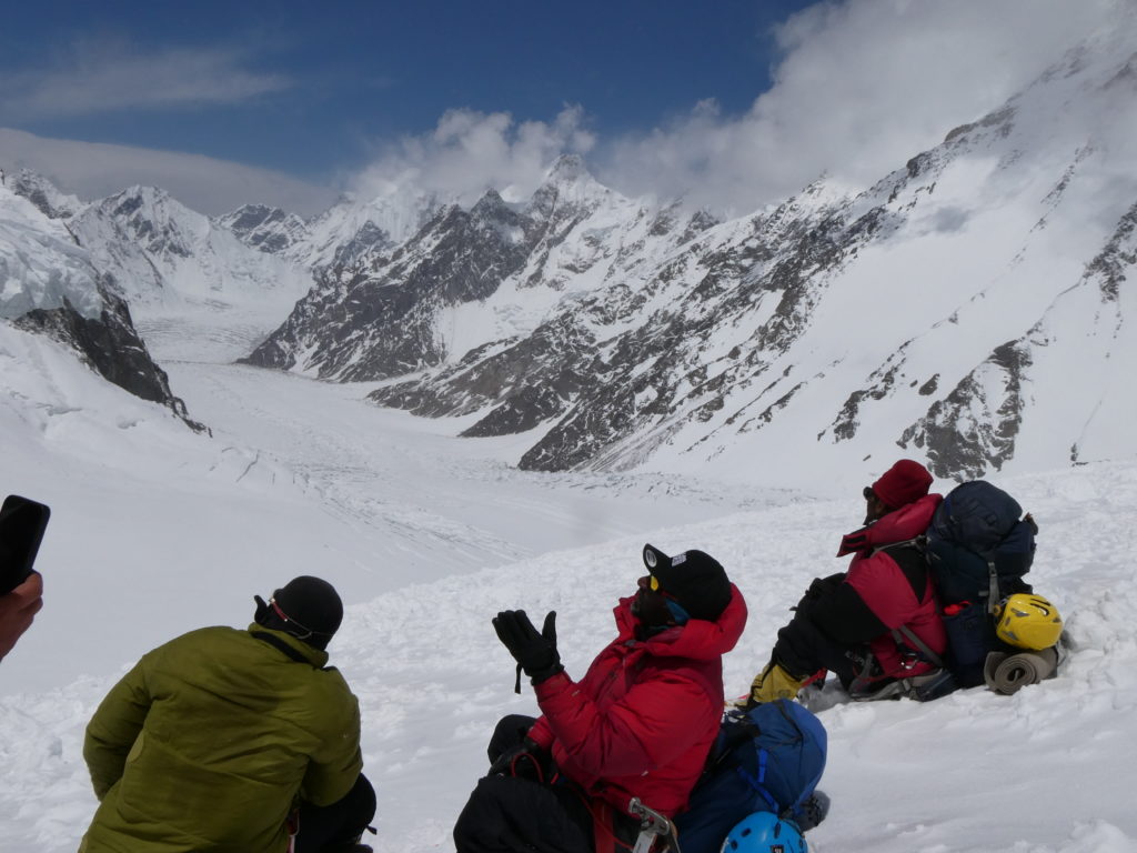
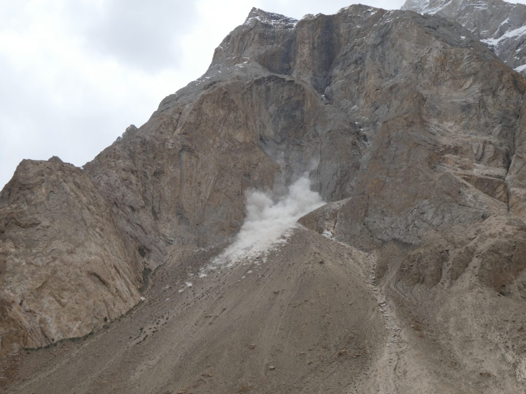
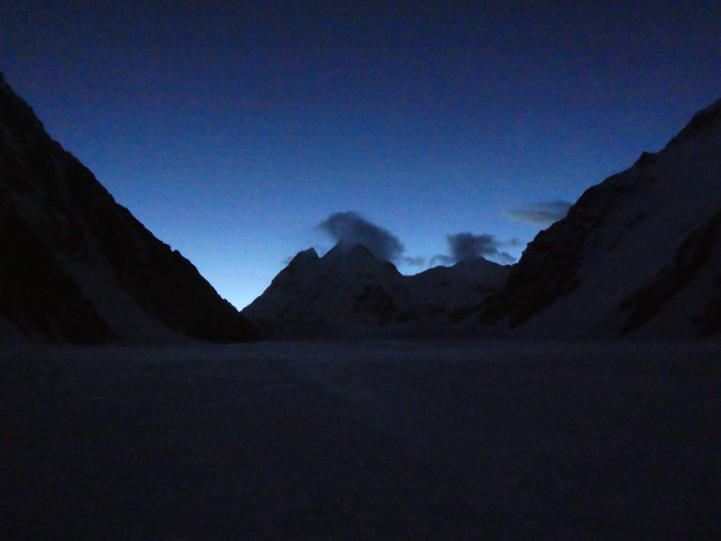
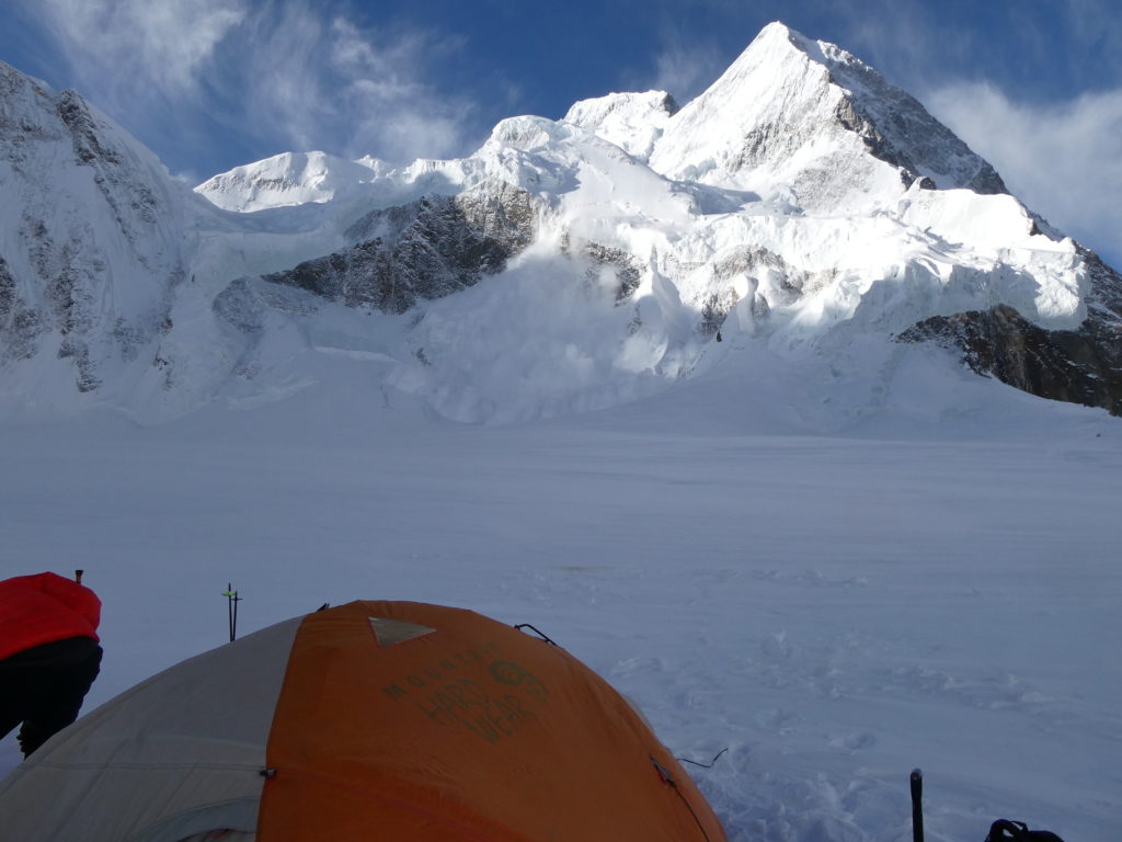
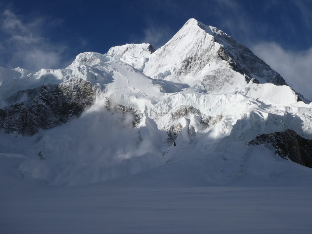
We spent the remainder of day resting and eating, to prepare ourselves for the slog of heading up the mountain on Saturday June 10. Our plan was to start walking around 6am, and see if we could make it to the col between Kharut II and the adjacent ‘Kharut Pyramid’. If we could reach that point, we would establish a high camp there, rest, then attempt the summit the following day if weather permitted. From our position we had epic and rarely seen views of K2, Broad Peak North Side, and Skyang Kangri. Huge avalanches were releasing from all aspects. The seracs on Broad Peak north side were enormous and constantly shedding killer chunks of ice.
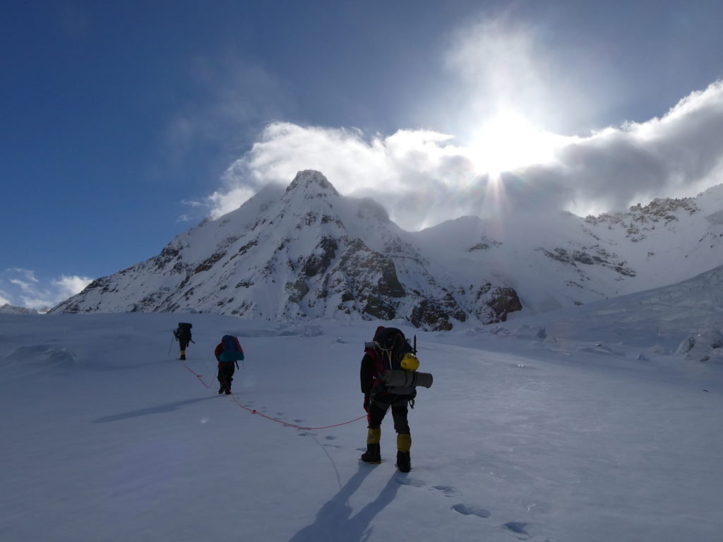
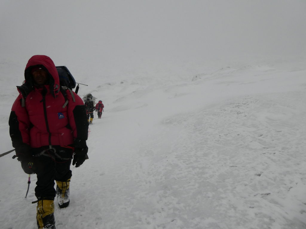
On Saturday June 10 we awoke at 5am and ate breakfast. We did not get moving until 7am due to the time required to break camp. It was clear and fine weather, however it felt extremely cold given the ~60km/h winds that seemed to be flowing down the southern slope of Kharut II towards us.
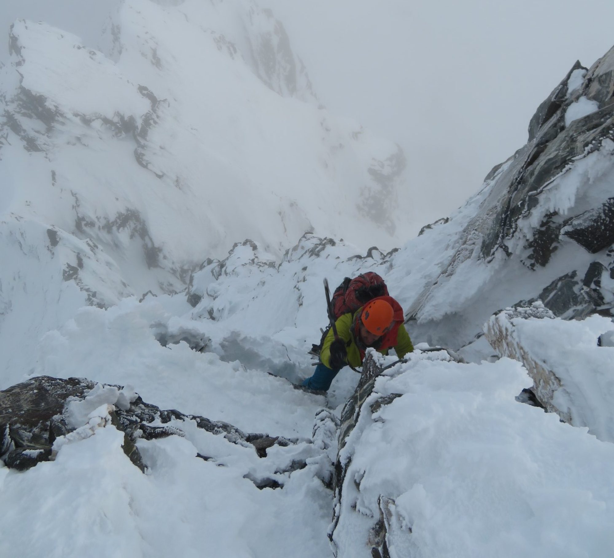
The whole way was crevassed, and I managed to fall into one up to my waist only 10 minutes from ABC. I was able to push myself out of the hole and continue on. The entire southern slope we wanted to ascend had been avalanching over the past 48 hours. We traversed over hardened avalanche debris, which ironically made for easier climbing than fresh soft snow. Crevasses littered the mountain side, Luke and I remained roped up to each other simul-climbing slowly. The Pakistani climbers did the same and followed closely behind.
This was the single most challenging day for me physically – I moved extremely slowly and always felt out of breath as we climbed the ~40° slope towards the col at ~6000m. Every step took will power and effort, I frequently had to stop to breath and avoid passing out. But we made slow and steady progress, with the cold wind dying away and the sun’s heat beginning to burn as the day moved on.
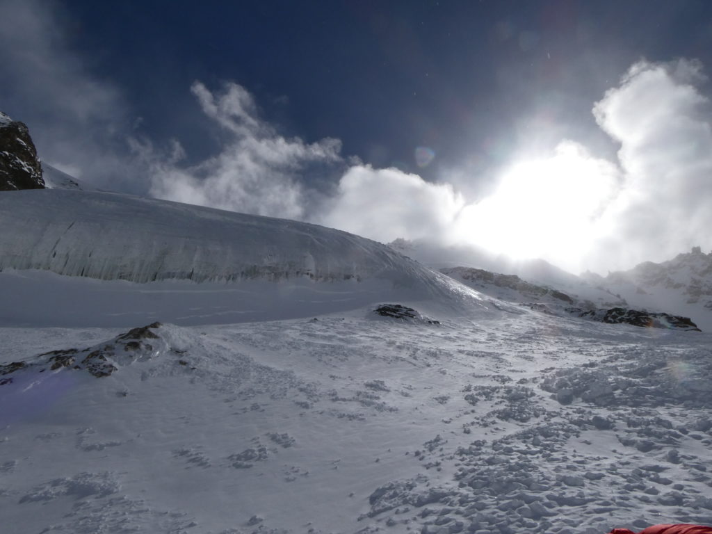
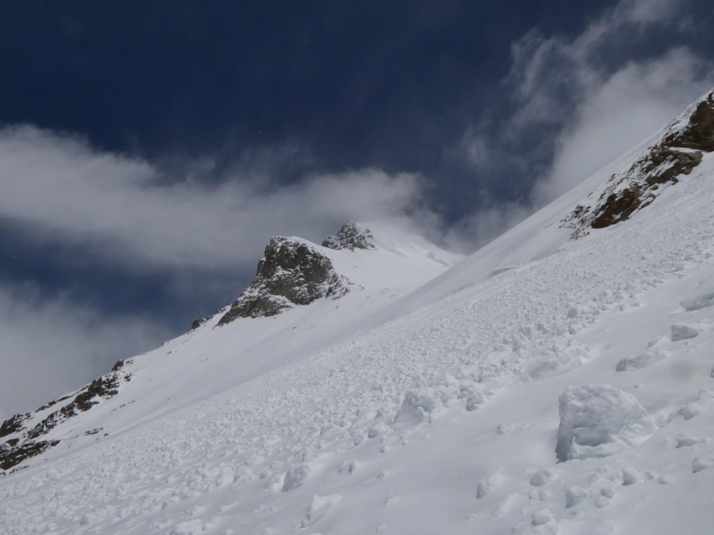
We got within 250m of the col which was our target for that day. However, we approached the crown of a slab avalanche so could get a better look at the snowpack which lay above us. Unfortunately, we found that there was ~60cm of new snow lying on top of a persistent planar layer of facets. A quick snowpack stability test showed that this fresh snow easily slid on top of the layer of weakness. Given there was still a very large mass of this new snow above us, we decided it was too risky to continue. The weakness was likely widespread, and in the heat of the afternoon sun the risk was only going to be amplified. The slope likely needed several weeks of stable weather before it would be in a safe condition to climb, so this was pretty much as far as we would get for the trip.
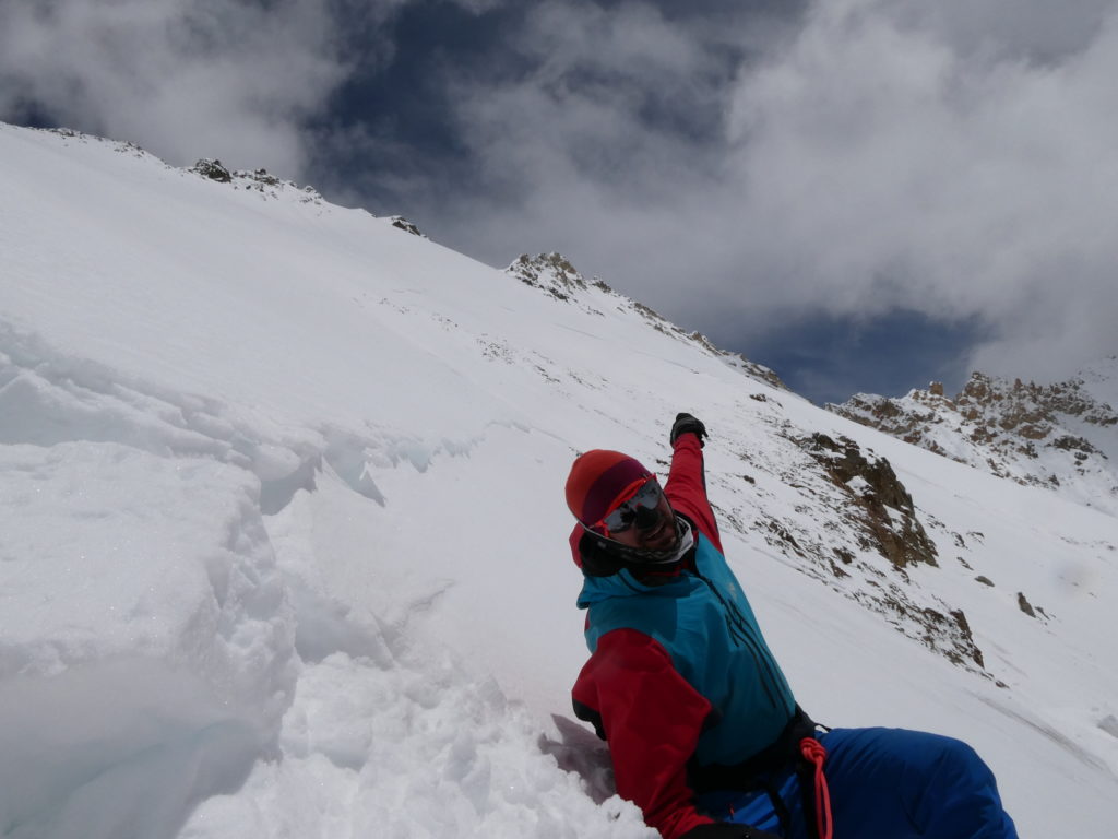
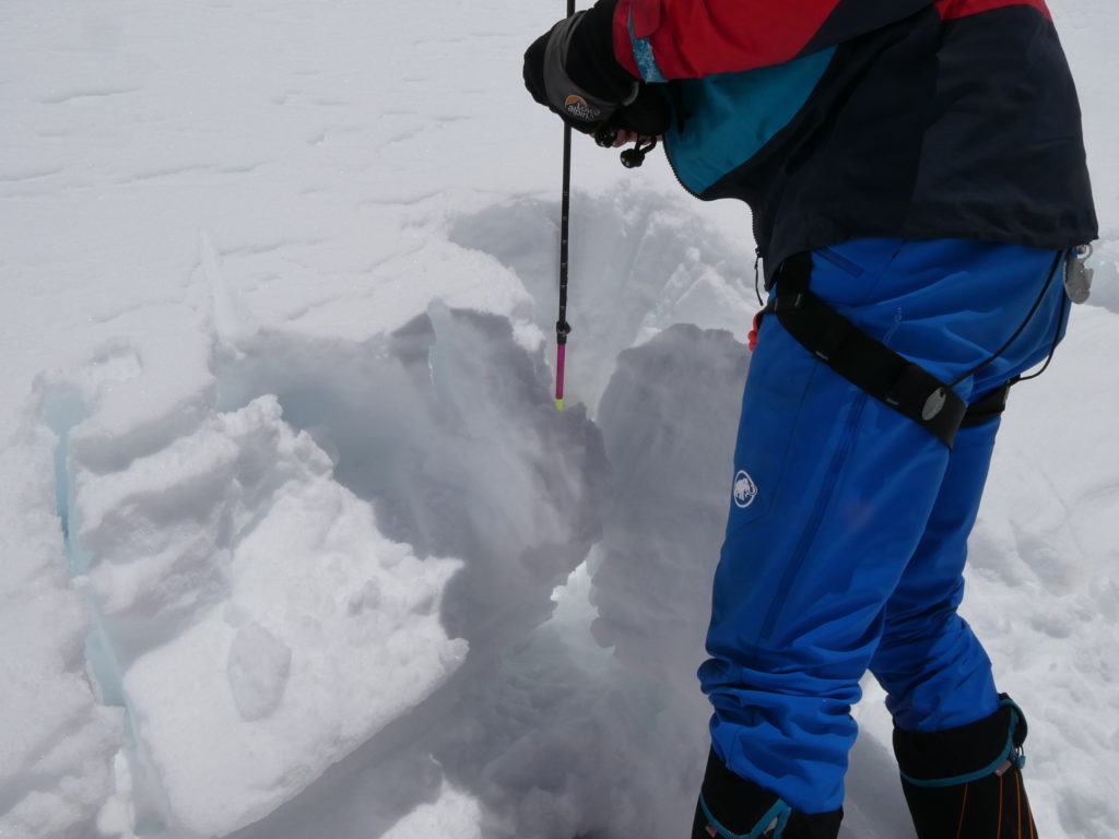
We turned around at ~5950m and retraced our steps towards ABC. We rested there for 2 hours, and then continued back to Base Camp in the late afternoon. Luke managed to have a very serious crevasse fall which I caught, and luckily our Pakistani climbers were right behind so were able to rapidly extract him using a drop loop system.
We were quite disappointed to realise this was the end of the trip. It was not for lack of trying or fitness, it was an objective assessment of the situation which could not have been made until we physically arrived to inspect the mountain with our own eyes. Still, the beauty of the surroundings and amazing views of some of the world’s highest peaks, made the journey worthwhile. It was an atmospheric march back down to Base Camp as light snow started to fall. We returned at about 7pm, and ate as much as we could before crashing and resting for 3 days, waiting for porters to come back up to meet us.
It took 4 days for us to return to Askole via the same route we had come, averaging about 20km a day. The weather was variable, sometime clear but often cloudy and snowing. As we descended, I gradually began to feel better and less breathless, as we walked into more and more oxygen-rich air. We were fortunate to get clear views of the Trango Towers, which inspired the imagination. The stunning Masherbrum also made some brief appearances from Goro II camp.
Upon reaching Askole, we immediately started the 6 hour drive back to Skardu on the same day. The shower and bed in the city hotel were extremely welcome after 3 weeks in the mountains. I was physically spent and happy to lie down all day.
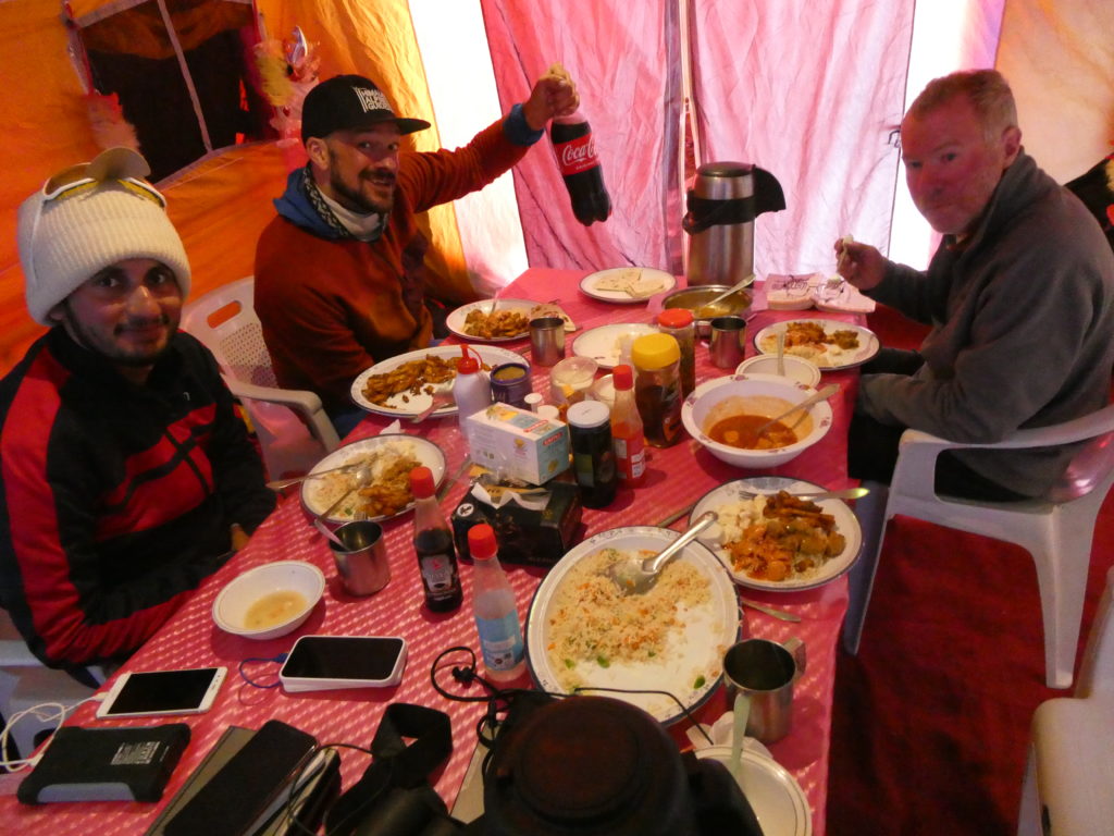
This was one of the hardest trips I’ve ever done from a physical and psychological point of view. The length of time required just to reach Base Camp, combined with the altitude effects, extreme heat and cold, and general difficulties of life on a glacier more than compensated for the lack of technical difficulty of our objective peak. Himalayan climbing is much less about technical prowess than it is about endurance, taking care of yourself, going slow to enable acclimatisation, and when required, digging deep and finding the will and determination to just keep marching, even when you feel terrible. The hazards we encountered were significant, and I’m happy to have been able to return home in one piece having seen Pakistan’s beauty, and having made some new great friends. The local porters and climbers were inspiring – their raw strength, power and the sheer positivity they always carried was uplifting, even on days when I felt physically terrible. Our Base Camp services staff also deserve the highest accolades – the food was amazing and there was plenty of it, always available whenever we requested. Pakistani people are incredibly friendly and courteous, and English is widely spoken making travelling relatively easy.
I do hope to return to Pakistan, perhaps to explore a different area such as Hunza Valley. The mountains are so expansive and steep, that there certainly are many lifetimes worth of virgin peaks and new routes to find. Kharut II Peak still stands unclimbed at the time of writing. I think it is a worthy objective that a competent party would surely succeed in summiting, given a stable snowpack and favourable weather window. I believe it’s unclimbed simply because of its remoteness and having been overlooked due to it’s relatively low altitude of ~6600m (compared to its giant neighbours). Despite its lack of prominence, it’s an ascetic peak that dominates the view to the north of K2 Base Camp and absolutely deserves to be climbed.